

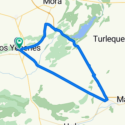
LosYebenes-Fuencaliente
A cycling route starting in Los Yébenes, Castille-La Mancha, Spain.
Overview
About this route
Default: 166 km, 1520 m elevation gain
Through a few towns: 166 km,
Option 1: from Cardena east small road: +4 km, +220 m elevation gain
Option 2: via Solano del Pino: +42 km, +1300 m elevation gain
- -:--
- Duration
- 166.3 km
- Distance
- 840 m
- Ascent
- 927 m
- Descent
- ---
- Avg. speed
- ---
- Max. altitude
Continue with Bikemap
Use, edit, or download this cycling route
You would like to ride LosYebenes-Fuencaliente or customize it for your own trip? Here is what you can do with this Bikemap route:
Free features
- Save this route as favorite or in collections
- Copy & plan your own version of this route
- Split it into stages to create a multi-day tour
- Sync your route with Garmin or Wahoo
Premium features
Free trial for 3 days, or one-time payment. More about Bikemap Premium.
- Navigate this route on iOS & Android
- Export a GPX / KML file of this route
- Create your custom printout (try it for free)
- Download this route for offline navigation
Discover more Premium features.
Get Bikemap PremiumFrom our community
Other popular routes starting in Los Yébenes
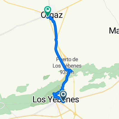
 De Los Yébenes a Calle Fuente Nueva
- Distance
- 62 km
- Ascent
- 360 m
- Descent
- 425 m
- Location
- Los Yébenes, Castille-La Mancha, Spain
 Los Yebenes_Porzuna 90km
- Distance
- 89.6 km
- Ascent
- 401 m
- Descent
- 545 m
- Location
- Los Yébenes, Castille-La Mancha, Spain
 De Calle San Marcos a Poligono Rustica
- Distance
- 2.7 km
- Ascent
- 145 m
- Descent
- 56 m
- Location
- Los Yébenes, Castille-La Mancha, Spain
 LosYebenes-Fuencaliente
- Distance
- 166.3 km
- Ascent
- 840 m
- Descent
- 927 m
- Location
- Los Yébenes, Castille-La Mancha, Spain
 Los Yebenes - PreUrda
- Distance
- 13.1 km
- Ascent
- 53 m
- Descent
- 111 m
- Location
- Los Yébenes, Castille-La Mancha, Spain
 10 ascensiones Pto. de Marjaliza (Toledo) 2 vertientes.
- Distance
- 57.6 km
- Ascent
- 1,419 m
- Descent
- 1,419 m
- Location
- Los Yébenes, Castille-La Mancha, Spain
 De Calle San Marcos a Camino Marjaliza 1D
- Distance
- 10.9 km
- Ascent
- 215 m
- Descent
- 251 m
- Location
- Los Yébenes, Castille-La Mancha, Spain
Open it in the app