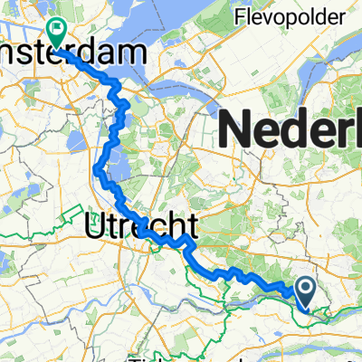
MTBroute-Rhenen 609 (c) MTBroutes.nl
A cycling route starting in Rhenen, Provincie Utrecht, Netherlands.
Overview
About this route
GPStrack alleen voor eigen gebruik / Commercieel gebruik niet toegestaan / (c) MTBroutesNL
- 27 min
- Duration
- 6.4 km
- Distance
- 86 m
- Ascent
- 84 m
- Descent
- 14.1 km/h
- Avg. speed
- ---
- Avg. speed
Continue with Bikemap
Use, edit, or download this cycling route
You would like to ride MTBroute-Rhenen 609 (c) MTBroutes.nl or customize it for your own trip? Here is what you can do with this Bikemap route:
Free features
- Save this route as favorite or in collections
- Copy & plan your own version of this route
- Sync your route with Garmin or Wahoo
Premium features
Free trial for 3 days, or one-time payment. More about Bikemap Premium.
- Navigate this route on iOS & Android
- Export a GPX / KML file of this route
- Create your custom printout (try it for free)
- Download this route for offline navigation
Discover more Premium features.
Get Bikemap PremiumFrom our community
Other popular routes starting in Rhenen
- Vanuit Rhenen over de Utrechtse Heuvelrug
- Distance
- 37.4 km
- Ascent
- 147 m
- Descent
- 150 m
- Location
- Rhenen, Provincie Utrecht, Netherlands
- MTBUH Verbinding Rhenen - Amerongen
- Distance
- 7 km
- Ascent
- 45 m
- Descent
- 76 m
- Location
- Rhenen, Provincie Utrecht, Netherlands
- MTB UH - Rhenen, Kwintelooijen, Amerongen, Leersum
- Distance
- 65.2 km
- Ascent
- 834 m
- Descent
- 835 m
- Location
- Rhenen, Provincie Utrecht, Netherlands
- MTBroute-Rhenen 609 (c) MTBroutes.nl
- Distance
- 6.4 km
- Ascent
- 86 m
- Descent
- 84 m
- Location
- Rhenen, Provincie Utrecht, Netherlands
- utrecht heuvelrug
- Distance
- 23 km
- Ascent
- 208 m
- Descent
- 177 m
- Location
- Rhenen, Provincie Utrecht, Netherlands
- EU 04 _ Rhenen - Utrecht _ 44 km
- Distance
- 43.8 km
- Ascent
- 39 m
- Descent
- 84 m
- Location
- Rhenen, Provincie Utrecht, Netherlands
- Rhenen Mook via Andelst
- Distance
- 43.8 km
- Ascent
- 72 m
- Descent
- 77 m
- Location
- Rhenen, Provincie Utrecht, Netherlands
- 't Pad terug onderlangs+dijk
- Distance
- 13.8 km
- Ascent
- 50 m
- Descent
- 52 m
- Location
- Rhenen, Provincie Utrecht, Netherlands
Open it in the app