
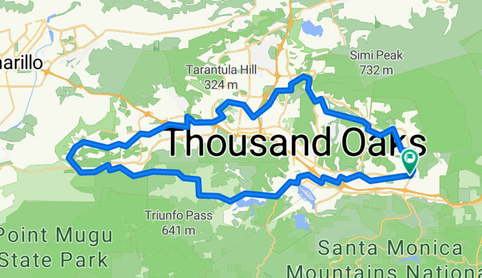
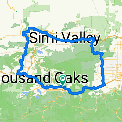
Easy TO loop through Hidden Valley
A cycling route starting in Agoura, California, United States.
Overview
About this route
- -:--
- Duration
- 61.9 km
- Distance
- 461 m
- Ascent
- 462 m
- Descent
- ---
- Avg. speed
- ---
- Max. altitude
Route quality
Waytypes & surfaces along the route
Waytypes
Quiet road
22.3 km
(36 %)
Road
19.8 km
(32 %)
Surfaces
Paved
14.2 km
(23 %)
Unpaved
1.2 km
(2 %)
Asphalt
11.1 km
(18 %)
Paved (undefined)
1.9 km
(3 %)
Continue with Bikemap
Use, edit, or download this cycling route
You would like to ride Easy TO loop through Hidden Valley or customize it for your own trip? Here is what you can do with this Bikemap route:
Free features
- Save this route as favorite or in collections
- Copy & plan your own version of this route
- Sync your route with Garmin or Wahoo
Premium features
Free trial for 3 days, or one-time payment. More about Bikemap Premium.
- Navigate this route on iOS & Android
- Export a GPX / KML file of this route
- Create your custom printout (try it for free)
- Download this route for offline navigation
Discover more Premium features.
Get Bikemap PremiumFrom our community
Other popular routes starting in Agoura
 Santa Suzana Mtn's loop
- Distance
- 89.1 km
- Ascent
- 777 m
- Descent
- 777 m
- Location
- Agoura, California, United States
 Stunt Piuma loop
- Distance
- 61.2 km
- Ascent
- 1,002 m
- Descent
- 999 m
- Location
- Agoura, California, United States
 Latigo Piccolo
- Distance
- 54.6 km
- Ascent
- 920 m
- Descent
- 920 m
- Location
- Agoura, California, United States
 Mullholland Highway to Cornell Rd
- Distance
- 21.4 km
- Ascent
- 274 m
- Descent
- 269 m
- Location
- Agoura, California, United States
 Conejo View Drive 28860, Agoura Hills to Conejo View Drive 28860, Agoura Hills
- Distance
- 23.8 km
- Ascent
- 444 m
- Descent
- 443 m
- Location
- Agoura, California, United States
 To Pedalers Fork from Agoura Hills1
- Distance
- 44.6 km
- Ascent
- 459 m
- Descent
- 456 m
- Location
- Agoura, California, United States
 Westlake Loop Route 30 mile ride
- Distance
- 52.2 km
- Ascent
- 672 m
- Descent
- 671 m
- Location
- Agoura, California, United States
 Malibu Rock Store, Deer Ck, & Yerba Buena Climbs
- Distance
- 83.3 km
- Ascent
- 1,360 m
- Descent
- 1,360 m
- Location
- Agoura, California, United States
Open it in the app