

Hagener Wälder
A cycling route starting in Hagen, North Rhine-Westphalia, Germany.
Overview
About this route
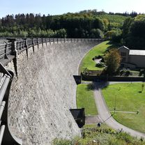
Schöne Traningsrunde durch die Wälder um Hagen. Kurze Verbindungsstücke führen über Straßen. Viel Spaß beim nachfahren.
- -:--
- Duration
- 56.7 km
- Distance
- 1,118 m
- Ascent
- 1,118 m
- Descent
- ---
- Avg. speed
- ---
- Max. altitude
Route quality
Waytypes & surfaces along the route
Waytypes
Track
23.7 km
(42 %)
Quiet road
15.7 km
(28 %)
Surfaces
Paved
25.2 km
(44 %)
Unpaved
26.8 km
(47 %)
Asphalt
23.3 km
(41 %)
Gravel
14.3 km
(25 %)
Continue with Bikemap
Use, edit, or download this cycling route
You would like to ride Hagener Wälder or customize it for your own trip? Here is what you can do with this Bikemap route:
Free features
- Save this route as favorite or in collections
- Copy & plan your own version of this route
- Sync your route with Garmin or Wahoo
Premium features
Free trial for 3 days, or one-time payment. More about Bikemap Premium.
- Navigate this route on iOS & Android
- Export a GPX / KML file of this route
- Create your custom printout (try it for free)
- Download this route for offline navigation
Discover more Premium features.
Get Bikemap PremiumFrom our community
Other popular routes starting in Hagen
 Rundkurs vom Hagen über Rüggeberg und Hasperbach
- Distance
- 56.5 km
- Ascent
- 968 m
- Descent
- 969 m
- Location
- Hagen, North Rhine-Westphalia, Germany
 Ruhrtal Radweg
- Distance
- 60.4 km
- Ascent
- 153 m
- Descent
- 206 m
- Location
- Hagen, North Rhine-Westphalia, Germany
 Haferkamp, Hagen nach Ruhrstraße, Schwerte
- Distance
- 17.8 km
- Ascent
- 78 m
- Descent
- 143 m
- Location
- Hagen, North Rhine-Westphalia, Germany
 Ruhr, Schwerte
- Distance
- 57.4 km
- Ascent
- 255 m
- Descent
- 255 m
- Location
- Hagen, North Rhine-Westphalia, Germany
 InterTabac A1 Team
- Distance
- 23.2 km
- Ascent
- 468 m
- Descent
- 446 m
- Location
- Hagen, North Rhine-Westphalia, Germany
 Hagener RTF
- Distance
- 111.9 km
- Ascent
- 1,529 m
- Descent
- 1,471 m
- Location
- Hagen, North Rhine-Westphalia, Germany
 Hagener Wälder
- Distance
- 56.7 km
- Ascent
- 1,118 m
- Descent
- 1,118 m
- Location
- Hagen, North Rhine-Westphalia, Germany
 Radrunde durch Hagen
- Distance
- 23.8 km
- Ascent
- 605 m
- Descent
- 605 m
- Location
- Hagen, North Rhine-Westphalia, Germany
Open it in the app