

20/ Etappe 5k2: Oberkirch-Meiringen (Glaubenbielen+Brünig)
A cycling route starting in Oberkirch, Canton of Lucerne, Switzerland.
Overview
About this route
- -:--
- Duration
- 87.6 km
- Distance
- 1,727 m
- Ascent
- 1,644 m
- Descent
- ---
- Avg. speed
- ---
- Max. altitude

Route quality
Waytypes & surfaces along the route
Waytypes
Road
23.7 km
(27 %)
Quiet road
8.8 km
(10 %)
Surfaces
Paved
36.8 km
(42 %)
Asphalt
36.8 km
(42 %)
Undefined
50.8 km
(58 %)
Continue with Bikemap
Use, edit, or download this cycling route
You would like to ride 20/ Etappe 5k2: Oberkirch-Meiringen (Glaubenbielen+Brünig) or customize it for your own trip? Here is what you can do with this Bikemap route:
Free features
- Save this route as favorite or in collections
- Copy & plan your own version of this route
- Split it into stages to create a multi-day tour
- Sync your route with Garmin or Wahoo
Premium features
Free trial for 3 days, or one-time payment. More about Bikemap Premium.
- Navigate this route on iOS & Android
- Export a GPX / KML file of this route
- Create your custom printout (try it for free)
- Download this route for offline navigation
Discover more Premium features.
Get Bikemap PremiumFrom our community
Other popular routes starting in Oberkirch
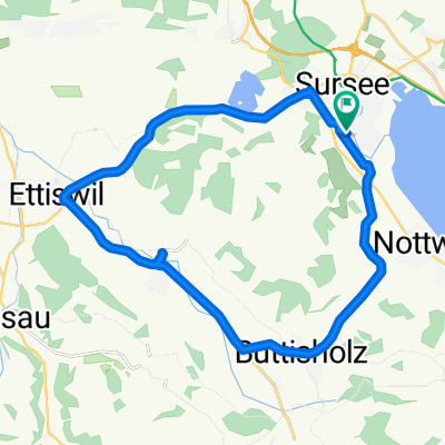 Oberkirch - Buttisholz - Ettiswil
- Distance
- 23.9 km
- Ascent
- 233 m
- Descent
- 178 m
- Location
- Oberkirch, Canton of Lucerne, Switzerland
 20/ Etappe 5k: Oberkirch-Meiringen (Glaubenberg+Brünig)
- Distance
- 82.1 km
- Ascent
- 1,709 m
- Descent
- 1,626 m
- Location
- Oberkirch, Canton of Lucerne, Switzerland
 RSC-Frühlingsbiketour 2023
- Distance
- 46.9 km
- Ascent
- 1,079 m
- Descent
- 1,082 m
- Location
- Oberkirch, Canton of Lucerne, Switzerland
 Oberkirch - Engelberg
- Distance
- 68.2 km
- Ascent
- 798 m
- Descent
- 280 m
- Location
- Oberkirch, Canton of Lucerne, Switzerland

Garmin
Oberkirch Cycling- Distance
- 18.9 km
- Ascent
- 33 m
- Descent
- 27 m
- Location
- Oberkirch, Canton of Lucerne, Switzerland
 20/ Etappe 5k2: Oberkirch-Meiringen (Glaubenbielen+Brünig)
- Distance
- 87.6 km
- Ascent
- 1,727 m
- Descent
- 1,644 m
- Location
- Oberkirch, Canton of Lucerne, Switzerland
 Am Hofbach 1, Oberkirch nach Sedelstrasse 41, Emmen
- Distance
- 19.7 km
- Ascent
- 79 m
- Descent
- 167 m
- Location
- Oberkirch, Canton of Lucerne, Switzerland
 Rund um Sempachersee
- Distance
- 19.6 km
- Ascent
- 145 m
- Descent
- 149 m
- Location
- Oberkirch, Canton of Lucerne, Switzerland
Open it in the app