

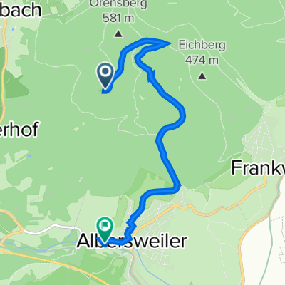
Modenbachtal-Tour mit ordentlich Höhenmetern
A cycling route starting in Dernbach, Rhineland-Palatinate, Germany.
Overview
About this route
Very beautiful tour through the Modenbach valley with 2 solid climbs averaging 6-7% gradient (total 600 m elevation gain). One climb to the 3 beeches (470 m above sea level), the second climb through the Modenbach valley to the 'Schänzel' at 580 m above sea level. The descent to Edenkoben promises breathtaking views of vineyards, the Rhine plain, and - depending on weather conditions - up to the Odenwald.
- -:--
- Duration
- 38.2 km
- Distance
- 652 m
- Ascent
- 652 m
- Descent
- ---
- Avg. speed
- ---
- Max. altitude
Route quality
Waytypes & surfaces along the route
Waytypes
Quiet road
11.5 km
(30 %)
Road
7.3 km
(19 %)
Surfaces
Paved
33.2 km
(87 %)
Unpaved
3.1 km
(8 %)
Asphalt
31.3 km
(82 %)
Gravel
2.7 km
(7 %)
Route highlights
Points of interest along the route
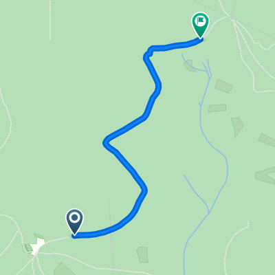
Point of interest after 3 km
Drei Buchen
Continue with Bikemap
Use, edit, or download this cycling route
You would like to ride Modenbachtal-Tour mit ordentlich Höhenmetern or customize it for your own trip? Here is what you can do with this Bikemap route:
Free features
- Save this route as favorite or in collections
- Copy & plan your own version of this route
- Sync your route with Garmin or Wahoo
Premium features
Free trial for 3 days, or one-time payment. More about Bikemap Premium.
- Navigate this route on iOS & Android
- Export a GPX / KML file of this route
- Create your custom printout (try it for free)
- Download this route for offline navigation
Discover more Premium features.
Get Bikemap PremiumFrom our community
Other popular routes starting in Dernbach
 Modenbachtal-Tour mit ordentlich Höhenmetern
- Distance
- 38.2 km
- Ascent
- 652 m
- Descent
- 652 m
- Location
- Dernbach, Rhineland-Palatinate, Germany
 Dernbach/Neuscharfeneck - Die Pfalz auf kurzer Strecke genießen!
- Distance
- 7.7 km
- Ascent
- 393 m
- Descent
- 387 m
- Location
- Dernbach, Rhineland-Palatinate, Germany
 Rundstrecke Eußertal, Helmbachweiher, Dernbachtal
- Distance
- 41.3 km
- Ascent
- 1,185 m
- Descent
- 1,184 m
- Location
- Dernbach, Rhineland-Palatinate, Germany
 Kandel - Limburgerhof
- Distance
- 56.2 km
- Ascent
- 540 m
- Descent
- 648 m
- Location
- Dernbach, Rhineland-Palatinate, Germany
 Orensfels 2
- Distance
- 5.5 km
- Ascent
- 38 m
- Descent
- 413 m
- Location
- Dernbach, Rhineland-Palatinate, Germany
 Dernbach nach Ringstraße 18A, Annweiler am Trifels
- Distance
- 5.3 km
- Ascent
- 66 m
- Descent
- 112 m
- Location
- Dernbach, Rhineland-Palatinate, Germany
 Landauer Hütte - Dreimärker
- Distance
- 2.1 km
- Ascent
- 119 m
- Descent
- 132 m
- Location
- Dernbach, Rhineland-Palatinate, Germany
 Frankweiler nach Godramsteiner Hauptstraße 67, Landau in der Pfalz
- Distance
- 24.3 km
- Ascent
- 279 m
- Descent
- 664 m
- Location
- Dernbach, Rhineland-Palatinate, Germany
Open it in the app