

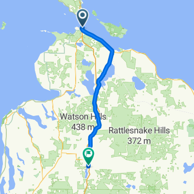
Mackinaw City to Cadillac
A cycling route starting in Saint Ignace, Michigan, United States.
Overview
About this route
Southern route from Mackinaw to Cadillac
- -:--
- Duration
- 227.5 km
- Distance
- 635 m
- Ascent
- 392 m
- Descent
- ---
- Avg. speed
- ---
- Max. altitude

Route quality
Waytypes & surfaces along the route
Waytypes
Quiet road
66 km
(29 %)
Cycleway
54.6 km
(24 %)
Surfaces
Paved
202.5 km
(89 %)
Unpaved
13.6 km
(6 %)
Paved (undefined)
159.2 km
(70 %)
Asphalt
43.2 km
(19 %)
Continue with Bikemap
Use, edit, or download this cycling route
You would like to ride Mackinaw City to Cadillac or customize it for your own trip? Here is what you can do with this Bikemap route:
Free features
- Save this route as favorite or in collections
- Copy & plan your own version of this route
- Split it into stages to create a multi-day tour
- Sync your route with Garmin or Wahoo
Premium features
Free trial for 3 days, or one-time payment. More about Bikemap Premium.
- Navigate this route on iOS & Android
- Export a GPX / KML file of this route
- Create your custom printout (try it for free)
- Download this route for offline navigation
Discover more Premium features.
Get Bikemap PremiumFrom our community
Other popular routes starting in Saint Ignace
 Mackinac Island
- Distance
- 37.1 km
- Ascent
- 88 m
- Descent
- 90 m
- Location
- Saint Ignace, Michigan, United States
 Long ride from Mackinaw City to Gaylord, MI
- Distance
- 108.5 km
- Ascent
- 314 m
- Descent
- 93 m
- Location
- Saint Ignace, Michigan, United States
 Mackinaw City to Charlevoix
- Distance
- 88.3 km
- Ascent
- 283 m
- Descent
- 273 m
- Location
- Saint Ignace, Michigan, United States
 Mackinaw City to Cadillac
- Distance
- 227.5 km
- Ascent
- 635 m
- Descent
- 392 m
- Location
- Saint Ignace, Michigan, United States
 Day 5: Mackinac Is > Mantistique
- Distance
- 151.4 km
- Ascent
- 206 m
- Descent
- 267 m
- Location
- Saint Ignace, Michigan, United States
 Route to 1131 N State St, Saint Ignace
- Distance
- 3 km
- Ascent
- 8 m
- Descent
- 0 m
- Location
- Saint Ignace, Michigan, United States
 Beir De Mac Growler
- Distance
- 24.7 km
- Ascent
- 50 m
- Descent
- 50 m
- Location
- Saint Ignace, Michigan, United States
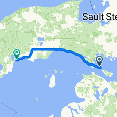
 Huron - Day 3-St Ignace to Sault Ste Marie
- Distance
- 120.4 km
- Ascent
- 233 m
- Descent
- 220 m
- Location
- Saint Ignace, Michigan, United States
Open it in the app