

2020-06-08 11:30:44
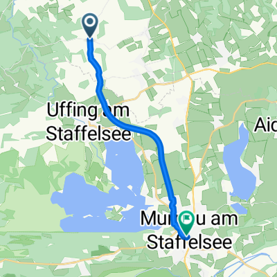
A cycling route starting in Eglfing, Bavaria, Germany.
Overview
About this route
,
, , , , , , , AktivitätRadfahrenDistanz114 kmErstellt2020-06-08 11:30:44Max. Tempo358 km/hPace (Min/Km)02:52 min/kmEnergieverbrauch20370 KJPunkte3708, , , Ges.Tempo > 0Tempo Ø20, 9 km/h22, 1 km/hTrackzeit5 h:25 min:58 sec5 h:08 min:31 sec, , Min. Höhe564 mMax. Höhe914 m, , , , HöhenmeterDistanzBergauf1747 m25124 mBergab-1751 m27851 mEbene0 m60740 m
,
- -:--
- Duration
- 105.2 km
- Distance
- 1,566 m
- Ascent
- 1,565 m
- Descent
- ---
- Avg. speed
- ---
- Max. altitude

Route quality
Waytypes & surfaces along the route
Waytypes
Quiet road
78.9 km
(75 %)
Road
13.7 km
(13 %)
Surfaces
Paved
91.5 km
(87 %)
Unpaved
1.1 km
(1 %)
Asphalt
91.5 km
(87 %)
Gravel
1.1 km
(1 %)
Undefined
12.6 km
(12 %)
Continue with Bikemap
Use, edit, or download this cycling route
You would like to ride 2020-06-08 11:30:44 or customize it for your own trip? Here is what you can do with this Bikemap route:
Free features
- Save this route as favorite or in collections
- Copy & plan your own version of this route
- Split it into stages to create a multi-day tour
- Sync your route with Garmin or Wahoo
Premium features
Free trial for 3 days, or one-time payment. More about Bikemap Premium.
- Navigate this route on iOS & Android
- Export a GPX / KML file of this route
- Create your custom printout (try it for free)
- Download this route for offline navigation
Discover more Premium features.
Get Bikemap PremiumFrom our community
Other popular routes starting in Eglfing
 Moosbrunnen 21, Eglfing nach Moosbrunnen 21, Eglfing
- Distance
- 28.2 km
- Ascent
- 214 m
- Descent
- 264 m
- Location
- Eglfing, Bavaria, Germany
 3R 2018/3
- Distance
- 50.1 km
- Ascent
- 268 m
- Descent
- 268 m
- Location
- Eglfing, Bavaria, Germany
 Tauting
- Distance
- 36.5 km
- Ascent
- 184 m
- Descent
- 136 m
- Location
- Eglfing, Bavaria, Germany
 Benediktweg 1, Eglfing nach Benediktweg 2, Eglfing
- Distance
- 26.6 km
- Ascent
- 257 m
- Descent
- 258 m
- Location
- Eglfing, Bavaria, Germany
 Benediktweg 1, Eglfing nach Benediktweg 1, Eglfing
- Distance
- 34.8 km
- Ascent
- 281 m
- Descent
- 285 m
- Location
- Eglfing, Bavaria, Germany
 Benediktweg 1, Eglfing nach Benediktweg 1, Eglfing
- Distance
- 26.6 km
- Ascent
- 323 m
- Descent
- 330 m
- Location
- Eglfing, Bavaria, Germany
 Hauptstraße 38, Eglfing nach Rathausstraße 1, Garmisch-Partenkirchen
- Distance
- 33.3 km
- Ascent
- 226 m
- Descent
- 164 m
- Location
- Eglfing, Bavaria, Germany
 Eglfing - Murnau am Staffelsee
- Distance
- 9.5 km
- Ascent
- 90 m
- Descent
- 66 m
- Location
- Eglfing, Bavaria, Germany
Open it in the app