
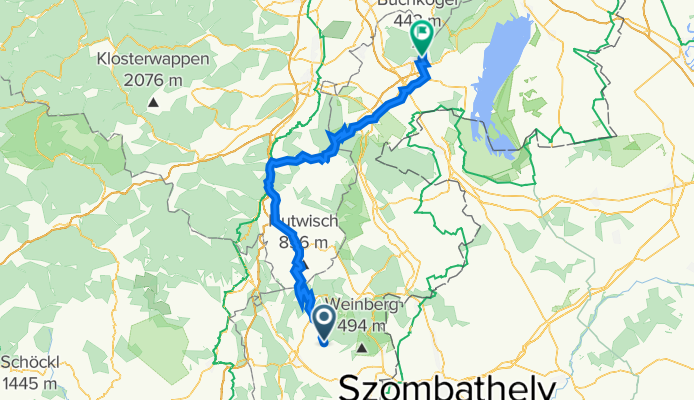
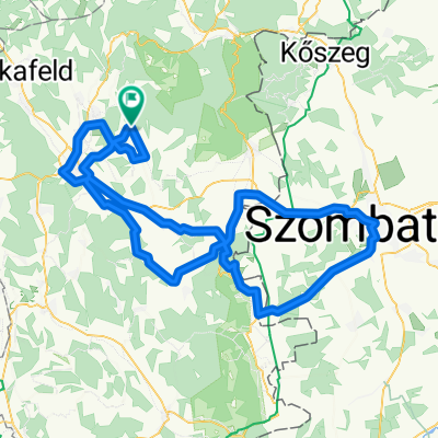
Schlaining-Schurldorf
A cycling route starting in Stadtschlaining, Burgenland, Austria.
Overview
About this route
- -:--
- Duration
- 111.4 km
- Distance
- 1,181 m
- Ascent
- 1,400 m
- Descent
- ---
- Avg. speed
- ---
- Max. altitude
Route quality
Waytypes & surfaces along the route
Waytypes
Busy road
44.9 km
(40 %)
Quiet road
29.9 km
(27 %)
Surfaces
Paved
57.5 km
(52 %)
Unpaved
1.2 km
(1 %)
Asphalt
53.6 km
(48 %)
Paved (undefined)
3.7 km
(3 %)
Route highlights
Points of interest along the route
Point of interest after 104.4 km
Eisbulle
Continue with Bikemap
Use, edit, or download this cycling route
You would like to ride Schlaining-Schurldorf or customize it for your own trip? Here is what you can do with this Bikemap route:
Free features
- Save this route as favorite or in collections
- Copy & plan your own version of this route
- Split it into stages to create a multi-day tour
- Sync your route with Garmin or Wahoo
Premium features
Free trial for 3 days, or one-time payment. More about Bikemap Premium.
- Navigate this route on iOS & Android
- Export a GPX / KML file of this route
- Create your custom printout (try it for free)
- Download this route for offline navigation
Discover more Premium features.
Get Bikemap PremiumFrom our community
Other popular routes starting in Stadtschlaining
 traninig friedensm.
- Distance
- 70.7 km
- Ascent
- 542 m
- Descent
- 542 m
- Location
- Stadtschlaining, Burgenland, Austria
 Family Strecke Radmarathon Stadt Schlaining
- Distance
- 61.7 km
- Ascent
- 478 m
- Descent
- 478 m
- Location
- Stadtschlaining, Burgenland, Austria
 Schlaining-Schurldorf
- Distance
- 111.4 km
- Ascent
- 1,181 m
- Descent
- 1,400 m
- Location
- Stadtschlaining, Burgenland, Austria
 Radmarathon Stadtschlaining
- Distance
- 58.1 km
- Ascent
- 413 m
- Descent
- 413 m
- Location
- Stadtschlaining, Burgenland, Austria
 Burgenlandi végvárak kerékpáron 3
- Distance
- 44.9 km
- Ascent
- 440 m
- Descent
- 551 m
- Location
- Stadtschlaining, Burgenland, Austria
 Stadtschlaining Light 2013
- Distance
- 118.8 km
- Ascent
- 590 m
- Descent
- 591 m
- Location
- Stadtschlaining, Burgenland, Austria
 Stadtschlaining Light 2013
- Distance
- 118.8 km
- Ascent
- 585 m
- Descent
- 585 m
- Location
- Stadtschlaining, Burgenland, Austria
 ParadiesrouteVar2
- Distance
- 277.5 km
- Ascent
- 3,407 m
- Descent
- 3,420 m
- Location
- Stadtschlaining, Burgenland, Austria
Open it in the app