

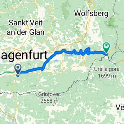
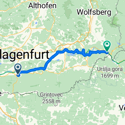
Ferlach - Lavamünd
A cycling route starting in Ferlach, Carinthia, Austria.
Overview
About this route
Ferlach, Glainach, Stein im Jauntal, Völkermarkt, Unarach, Ratschitschach, St. Lorenzen, Obermitterdorf, St. Nikolai, Oberdorf, Neuhaus, Pudlach, Lavamünd
- -:--
- Duration
- 71.7 km
- Distance
- 203 m
- Ascent
- 323 m
- Descent
- ---
- Avg. speed
- ---
- Max. altitude

Route quality
Waytypes & surfaces along the route
Waytypes
Quiet road
25.8 km
(36 %)
Cycleway
17.9 km
(25 %)
Surfaces
Paved
40.2 km
(56 %)
Unpaved
25.8 km
(36 %)
Asphalt
40.2 km
(56 %)
Gravel
25.8 km
(36 %)
Undefined
5.7 km
(8 %)
Continue with Bikemap
Use, edit, or download this cycling route
You would like to ride Ferlach - Lavamünd or customize it for your own trip? Here is what you can do with this Bikemap route:
Free features
- Save this route as favorite or in collections
- Copy & plan your own version of this route
- Sync your route with Garmin or Wahoo
Premium features
Free trial for 3 days, or one-time payment. More about Bikemap Premium.
- Navigate this route on iOS & Android
- Export a GPX / KML file of this route
- Create your custom printout (try it for free)
- Download this route for offline navigation
Discover more Premium features.
Get Bikemap PremiumFrom our community
Other popular routes starting in Ferlach
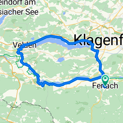
 Drau Mur Runde 04
- Distance
- 49.9 km
- Ascent
- 180 m
- Descent
- 215 m
- Location
- Ferlach, Carinthia, Austria
 Race around Carinthia
- Distance
- 573.8 km
- Ascent
- 5,163 m
- Descent
- 5,164 m
- Location
- Ferlach, Carinthia, Austria
 04 Rosental - Ferlach - Rosegg - Faaker See
- Distance
- 49.5 km
- Ascent
- 337 m
- Descent
- 194 m
- Location
- Ferlach, Carinthia, Austria
 Ferlach - Lavamünd 2
- Distance
- 73.2 km
- Ascent
- 297 m
- Descent
- 416 m
- Location
- Ferlach, Carinthia, Austria
 Drauradweg Etappe 5: Ferlach-Lavamünd/Jauntal
- Distance
- 73.4 km
- Ascent
- 688 m
- Descent
- 780 m
- Location
- Ferlach, Carinthia, Austria
 Ferlach - Lavamünd 3
- Distance
- 74.5 km
- Ascent
- 274 m
- Descent
- 393 m
- Location
- Ferlach, Carinthia, Austria
 EE Wandertag Glainach - Variante Wasserleitung
- Distance
- 30.2 km
- Ascent
- 769 m
- Descent
- 771 m
- Location
- Ferlach, Carinthia, Austria
 Route to Pfarrkirche Heiliger Martin in Ferlach/Borovlje
- Distance
- 70.9 km
- Ascent
- 579 m
- Descent
- 579 m
- Location
- Ferlach, Carinthia, Austria
Open it in the app