

RCO 2012 Römer Radweg
RCO 2012 Römer-Radweg 1. Tag Teil 2
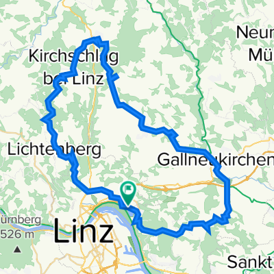
A cycling route starting in Linz, Upper Austria, Austria.
Overview
About this route
June 7, 2012 Upper Austria Tour
Linz Station - Danube Cycle Path R1 - Aschach on the Danube - Wesenufer
- -:--
- Duration
- 65.6 km
- Distance
- 166 m
- Ascent
- 141 m
- Descent
- ---
- Avg. speed
- ---
- Max. altitude

Part of
RCO 2012 Römer Radweg
4 stages
Route quality
Waytypes & surfaces along the route
Waytypes
Quiet road
36.1 km
(55 %)
Cycleway
15.7 km
(24 %)
Surfaces
Paved
58.4 km
(89 %)
Asphalt
57.1 km
(87 %)
Paved (undefined)
0.7 km
(1 %)
Route highlights
Points of interest along the route
Point of interest after 34.3 km
Essen "Zur Sonne"
Continue with Bikemap
Use, edit, or download this cycling route
You would like to ride RCO 2012 Römer-Radweg 1. Tag Teil 2 or customize it for your own trip? Here is what you can do with this Bikemap route:
Free features
- Save this route as favorite or in collections
- Copy & plan your own version of this route
- Sync your route with Garmin or Wahoo
Premium features
Free trial for 3 days, or one-time payment. More about Bikemap Premium.
- Navigate this route on iOS & Android
- Export a GPX / KML file of this route
- Create your custom printout (try it for free)
- Download this route for offline navigation
Discover more Premium features.
Get Bikemap PremiumFrom our community
Other popular routes starting in Linz
 Oberbairing-Altenberg-Galli-Linz
- Distance
- 27.8 km
- Ascent
- 496 m
- Descent
- 496 m
- Location
- Linz, Upper Austria, Austria
 Lichtenberg, Mirellental, Pfenningberg CLONED FROM ROUTE 38001
- Distance
- 54.3 km
- Ascent
- 1,090 m
- Descent
- 1,093 m
- Location
- Linz, Upper Austria, Austria
 Steyregg Runde
- Distance
- 22 km
- Ascent
- 218 m
- Descent
- 220 m
- Location
- Linz, Upper Austria, Austria
 Lange Ausfahrt durch Linz
- Distance
- 45 km
- Ascent
- 634 m
- Descent
- 622 m
- Location
- Linz, Upper Austria, Austria
 Giselawarte - GIS
- Distance
- 27.7 km
- Ascent
- 914 m
- Descent
- 834 m
- Location
- Linz, Upper Austria, Austria
 Pfenningberg Tour
- Distance
- 28.9 km
- Ascent
- 458 m
- Descent
- 458 m
- Location
- Linz, Upper Austria, Austria
 Trail GIS – Bachlberg Variante01
- Distance
- 21.7 km
- Ascent
- 713 m
- Descent
- 850 m
- Location
- Linz, Upper Austria, Austria
 Eine kleine Runde bei Linz
- Distance
- 21.4 km
- Ascent
- 541 m
- Descent
- 444 m
- Location
- Linz, Upper Austria, Austria
Open it in the app