

Unnamed Road do Clifton Road 37
A cycling route starting in Dunchurch, England, United Kingdom.
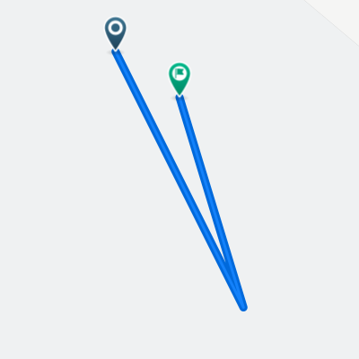
Overview
About this route
- 1 h 16 min
- Duration
- 19.9 km
- Distance
- 121 m
- Ascent
- 102 m
- Descent
- 15.8 km/h
- Avg. speed
- ---
- Max. altitude

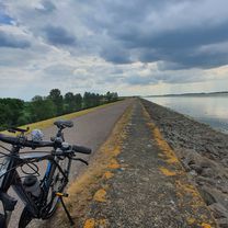
Route photos

Route quality
Waytypes & surfaces along the route
Waytypes
Cycleway
8.2 km
(41 %)
Access road
5.2 km
(26 %)
Surfaces
Paved
5.9 km
(30 %)
Asphalt
5.9 km
(30 %)
Undefined
14 km
(70 %)
Continue with Bikemap
Use, edit, or download this cycling route
You would like to ride Unnamed Road do Clifton Road 37 or customize it for your own trip? Here is what you can do with this Bikemap route:
Free features
- Save this route as favorite or in collections
- Copy & plan your own version of this route
- Sync your route with Garmin or Wahoo
Premium features
Free trial for 3 days, or one-time payment. More about Bikemap Premium.
- Navigate this route on iOS & Android
- Export a GPX / KML file of this route
- Create your custom printout (try it for free)
- Download this route for offline navigation
Discover more Premium features.
Get Bikemap PremiumFrom our community
Other popular routes starting in Dunchurch
 Draycote Water and around
- Distance
- 35.2 km
- Ascent
- 201 m
- Descent
- 204 m
- Location
- Dunchurch, England, United Kingdom
 National Cycle Route 41 to Brandon Road
- Distance
- 13 km
- Ascent
- 89 m
- Descent
- 137 m
- Location
- Dunchurch, England, United Kingdom
 8km lake loop
- Distance
- 8.3 km
- Ascent
- 37 m
- Descent
- 48 m
- Location
- Dunchurch, England, United Kingdom
 Unnamed Road do Clifton Road 37
- Distance
- 19.9 km
- Ascent
- 121 m
- Descent
- 102 m
- Location
- Dunchurch, England, United Kingdom
 draycote
- Distance
- 7.6 km
- Ascent
- 46 m
- Descent
- 46 m
- Location
- Dunchurch, England, United Kingdom
 Draycote Water to Halfway Lane
- Distance
- 2.7 km
- Ascent
- 39 m
- Descent
- 17 m
- Location
- Dunchurch, England, United Kingdom
 12345
12345- Distance
- 0 km
- Ascent
- 0 m
- Descent
- 0 m
- Location
- Dunchurch, England, United Kingdom
 Trussell Way 43, Cawston to Trussell Way 43, Cawston
- Distance
- 13.3 km
- Ascent
- 64 m
- Descent
- 66 m
- Location
- Dunchurch, England, United Kingdom
Open it in the app