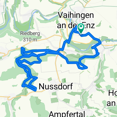
Kleine Trainingsrunde
- 18.8 km
- 200 m
- 196 m
- Vaihingen an der Enz, Baden-Wurttemberg, Germany
A cycling route starting in Vaihingen an der Enz, Baden-Wurttemberg, Germany.
Overview
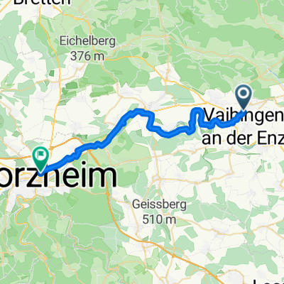
A route of the RadSporSenioren Rheinstetten from 04.08.2010
Arrival from Karlsruhe HBH to Vaihingen-Enz by regional train R5
Enjoying culture is especially worthwhile in Besigheim, Marbach, Ludwigsburg, Markgröningen.
Landscape enjoyment is offered by the following viewpoints: Wunnenstein Castle, Lichtenberg Castle, Hoher Asperg Castle.
Participants: Peter as tour leader with excellent detailed knowledge of the route, Martin, Wolfgang K. & Jürgen.
Measured values including arrival and return to Karlsruhe station: 152 km; 1460 m elevation gain.
created this 15 years ago
Route quality
Road
30.2 km
(22 %)
Quiet road
27.4 km
(20 %)
Paved
120.6 km
(88 %)
Unpaved
8.2 km
(6 %)
Asphalt
115.1 km
(84 %)
Paved (undefined)
4.1 km
(3 %)
Route highlights
Burg Wunnenstein mit herrlichem Ausblick
Burg Lichtenberg
Der hohe Asperg bietet einen herrlichen Blick ins Neckartal.
Continue with Bikemap
You would like to ride zur Kultur, Kunst & Landschaftsgenuß im Neckartal - mit großer Schleife -- Start & Ziel = Vaihingen-Enz Bahnhof or customize it for your own trip? Here is what you can do with this Bikemap route:
Free trial for 3 days, or one-time payment. More about Bikemap Premium.
Discover more Premium features.
Get Bikemap PremiumFrom our community
Open it in the app