

Sellaronda con partenza da Santa Fosca
A cycling route starting in Selva di Cadore, Veneto, Italy.
Overview
About this route
The classic tour of the four Dolomite passes Pordoi - Sella - Gardena - Campolongo starting from Santa Fosca (Selva di Cadore)
- -:--
- Duration
- 103.8 km
- Distance
- 2,293 m
- Ascent
- 2,293 m
- Descent
- ---
- Avg. speed
- ---
- Max. altitude

Route quality
Waytypes & surfaces along the route
Waytypes
Quiet road
4.2 km
(4 %)
Track
2.1 km
(2 %)
Surfaces
Paved
98.6 km
(95 %)
Unpaved
2.1 km
(2 %)
Asphalt
98.6 km
(95 %)
Unpaved (undefined)
1 km
(1 %)
Continue with Bikemap
Use, edit, or download this cycling route
You would like to ride Sellaronda con partenza da Santa Fosca or customize it for your own trip? Here is what you can do with this Bikemap route:
Free features
- Save this route as favorite or in collections
- Copy & plan your own version of this route
- Split it into stages to create a multi-day tour
- Sync your route with Garmin or Wahoo
Premium features
Free trial for 3 days, or one-time payment. More about Bikemap Premium.
- Navigate this route on iOS & Android
- Export a GPX / KML file of this route
- Create your custom printout (try it for free)
- Download this route for offline navigation
Discover more Premium features.
Get Bikemap PremiumFrom our community
Other popular routes starting in Selva di Cadore
 Selva Di Cadore - Passo Staulanza - Passo Duran -
- Distance
- 69.7 km
- Ascent
- 1,744 m
- Descent
- 1,751 m
- Location
- Selva di Cadore, Veneto, Italy
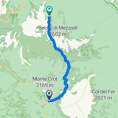 Staulanza- Rif Città di Fiume - Forcella Ambrizzola -Croda del Lago
- Distance
- 9.9 km
- Ascent
- 642 m
- Descent
- 376 m
- Location
- Selva di Cadore, Veneto, Italy
 Tag 4 Dolo-Runde
- Distance
- 34.4 km
- Ascent
- 817 m
- Descent
- 2,243 m
- Location
- Selva di Cadore, Veneto, Italy
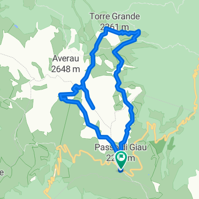
 Pocol-Cortina-PassoGiau-Rif.Fedare-CinqueTorri-SR48-Pocol
- Distance
- 26.2 km
- Ascent
- 1,140 m
- Descent
- 1,135 m
- Location
- Selva di Cadore, Veneto, Italy
 Rifugio Lusia
- Distance
- 62.3 km
- Ascent
- 2,078 m
- Descent
- 2,443 m
- Location
- Selva di Cadore, Veneto, Italy
 Q 9/16 Selva di Cadore to Palmanova
- Distance
- 171 km
- Ascent
- 787 m
- Descent
- 2,191 m
- Location
- Selva di Cadore, Veneto, Italy
 Passo Giao - Passo Falzarego - St. Martin in Gsies
- Distance
- 96.9 km
- Ascent
- 1,599 m
- Descent
- 2,541 m
- Location
- Selva di Cadore, Veneto, Italy
 Anello Passo Giau - 5 Torri
- Distance
- 10.9 km
- Ascent
- 571 m
- Descent
- 571 m
- Location
- Selva di Cadore, Veneto, Italy
Open it in the app