

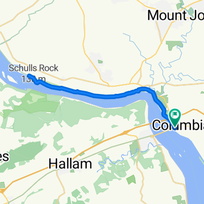
Lancaster County Northwest River Trail
A cycling route starting in Columbia, Pennsylvania, United States.
Overview
About this route
- 2 h 39 min
- Duration
- 45.9 km
- Distance
- 205 m
- Ascent
- 206 m
- Descent
- 17.3 km/h
- Avg. speed
- ---
- Max. altitude

Route quality
Waytypes & surfaces along the route
Waytypes
Cycleway
41.2 km
(90 %)
Quiet road
1.8 km
(4 %)
Surfaces
Paved
39.6 km
(86 %)
Unpaved
2.8 km
(6 %)
Asphalt
35.2 km
(77 %)
Paved (undefined)
3.6 km
(8 %)
Continue with Bikemap
Use, edit, or download this cycling route
You would like to ride Lancaster County Northwest River Trail or customize it for your own trip? Here is what you can do with this Bikemap route:
Free features
- Save this route as favorite or in collections
- Copy & plan your own version of this route
- Sync your route with Garmin or Wahoo
Premium features
Free trial for 3 days, or one-time payment. More about Bikemap Premium.
- Navigate this route on iOS & Android
- Export a GPX / KML file of this route
- Create your custom printout (try it for free)
- Download this route for offline navigation
Discover more Premium features.
Get Bikemap PremiumFrom our community
Other popular routes starting in Columbia
 41 Walnut St, Columbia to 41 Walnut St, Columbia
- Distance
- 45.8 km
- Ascent
- 108 m
- Descent
- 111 m
- Location
- Columbia, Pennsylvania, United States
 North Front Street 4525, Columbia to Locust Street 2-68, Columbia
- Distance
- 21.3 km
- Ascent
- 176 m
- Descent
- 177 m
- Location
- Columbia, Pennsylvania, United States
 Northwest Lancaster County River Trail, Columbia do North Main Street 201, Los Angeles
- Distance
- 5,483.5 km
- Ascent
- 52,225 m
- Descent
- 52,214 m
- Location
- Columbia, Pennsylvania, United States
 Walnut St, Columbia to Walnut St, Columbia
- Distance
- 29.1 km
- Ascent
- 69 m
- Descent
- 68 m
- Location
- Columbia, Pennsylvania, United States
 N Heritage Dr, Columbia to Columbia
- Distance
- 18.7 km
- Ascent
- 60 m
- Descent
- 53 m
- Location
- Columbia, Pennsylvania, United States
 Sporty route in Wrightsville
- Distance
- 21.2 km
- Ascent
- 419 m
- Descent
- 299 m
- Location
- Columbia, Pennsylvania, United States
 41 Walnut St, Columbia to 145 Delp Rd, Lancaster
- Distance
- 22.5 km
- Ascent
- 222 m
- Descent
- 170 m
- Location
- Columbia, Pennsylvania, United States
 Pennsylvania 441, Columbia to Pennsylvania 441, Columbia
- Distance
- 8.4 km
- Ascent
- 57 m
- Descent
- 49 m
- Location
- Columbia, Pennsylvania, United States
Open it in the app