

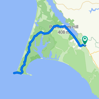
route 20
A cycling route starting in Inverness, California, United States.
Overview
About this route
- -:--
- Duration
- 43.7 km
- Distance
- 344 m
- Ascent
- 376 m
- Descent
- ---
- Avg. speed
- ---
- Max. altitude

Route quality
Waytypes & surfaces along the route
Waytypes
Quiet road
6.1 km
(14 %)
Cycleway
5.2 km
(12 %)
Surfaces
Paved
16.6 km
(38 %)
Asphalt
14.4 km
(33 %)
Paved (undefined)
2.2 km
(5 %)
Undefined
27.1 km
(62 %)
Continue with Bikemap
Use, edit, or download this cycling route
You would like to ride route 20 or customize it for your own trip? Here is what you can do with this Bikemap route:
Free features
- Save this route as favorite or in collections
- Copy & plan your own version of this route
- Sync your route with Garmin or Wahoo
Premium features
Free trial for 3 days, or one-time payment. More about Bikemap Premium.
- Navigate this route on iOS & Android
- Export a GPX / KML file of this route
- Create your custom printout (try it for free)
- Download this route for offline navigation
Discover more Premium features.
Get Bikemap PremiumFrom our community
Other popular routes starting in Inverness
 Point Reyes Ride
- Distance
- 26.8 km
- Ascent
- 305 m
- Descent
- 333 m
- Location
- Inverness, California, United States
 Pierce Point
- Distance
- 26.5 km
- Ascent
- 391 m
- Descent
- 350 m
- Location
- Inverness, California, United States
 Point reyes station to point out and back
- Distance
- 63.7 km
- Ascent
- 714 m
- Descent
- 714 m
- Location
- Inverness, California, United States
 Point Reyes, CA -USA
- Distance
- 64 km
- Ascent
- 572 m
- Descent
- 577 m
- Location
- Inverness, California, United States
 Point Reyes Out & Back
- Distance
- 96.8 km
- Ascent
- 729 m
- Descent
- 624 m
- Location
- Inverness, California, United States
 route 20
- Distance
- 43.7 km
- Ascent
- 344 m
- Descent
- 376 m
- Location
- Inverness, California, United States
 PointReyes-RussionRiver-Run
- Distance
- 147.8 km
- Ascent
- 618 m
- Descent
- 618 m
- Location
- Inverness, California, United States
 Leon Marshall Wall and Wilson Hill
- Distance
- 98.3 km
- Ascent
- 1,271 m
- Descent
- 1,276 m
- Location
- Inverness, California, United States
Open it in the app