

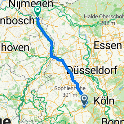
Erft-Radweg - von Sindorf zur Mündung
A cycling route starting in Kerpen, North Rhine-Westphalia, Germany.
Overview
About this route
- -:--
- Duration
- 34.5 km
- Distance
- 4 m
- Ascent
- 23 m
- Descent
- ---
- Avg. speed
- ---
- Max. altitude

Route quality
Waytypes & surfaces along the route
Waytypes
Track
14.8 km
(43 %)
Path
9.7 km
(28 %)
Surfaces
Paved
14.5 km
(42 %)
Unpaved
13.8 km
(40 %)
Gravel
12.1 km
(35 %)
Asphalt
9 km
(26 %)
Route highlights
Points of interest along the route
Point of interest after 0 km
Snidorf Bf. Am Bahnhof 50170 Kerpen (Sindorf)
Point of interest after 12.4 km
Schloß Paffendorf
Point of interest after 30.1 km
Tiergehege Benden
Accommodation after 34.5 km
Point of interest after 34.5 km
Schloss Hülchrath
Point of interest after 34.5 km
Bahnhof Norf Bahnstr., 41469 Neuss
Continue with Bikemap
Use, edit, or download this cycling route
You would like to ride Erft-Radweg - von Sindorf zur Mündung or customize it for your own trip? Here is what you can do with this Bikemap route:
Free features
- Save this route as favorite or in collections
- Copy & plan your own version of this route
- Sync your route with Garmin or Wahoo
Premium features
Free trial for 3 days, or one-time payment. More about Bikemap Premium.
- Navigate this route on iOS & Android
- Export a GPX / KML file of this route
- Create your custom printout (try it for free)
- Download this route for offline navigation
Discover more Premium features.
Get Bikemap PremiumFrom our community
Other popular routes starting in Kerpen
 Bergheimer Acht
- Distance
- 58.9 km
- Ascent
- 120 m
- Descent
- 146 m
- Location
- Kerpen, North Rhine-Westphalia, Germany
 Rund um die Erft und Boisdorfer See
- Distance
- 17.6 km
- Ascent
- 65 m
- Descent
- 65 m
- Location
- Kerpen, North Rhine-Westphalia, Germany
 Erftkreisrunde
- Distance
- 39.1 km
- Ascent
- 108 m
- Descent
- 109 m
- Location
- Kerpen, North Rhine-Westphalia, Germany
 Kerpen - Mettmann
- Distance
- 74.3 km
- Ascent
- 332 m
- Descent
- 227 m
- Location
- Kerpen, North Rhine-Westphalia, Germany
 Rund um den Tagebau Hambach
- Distance
- 60.9 km
- Ascent
- 130 m
- Descent
- 115 m
- Location
- Kerpen, North Rhine-Westphalia, Germany
 Kerpen - Boxmeer
- Distance
- 130.9 km
- Ascent
- 346 m
- Descent
- 412 m
- Location
- Kerpen, North Rhine-Westphalia, Germany
 Erft-Radweg - von Sindorf zur Mündung
- Distance
- 34.5 km
- Ascent
- 4 m
- Descent
- 23 m
- Location
- Kerpen, North Rhine-Westphalia, Germany
 Tagebau Rundtour
- Distance
- 52.1 km
- Ascent
- 91 m
- Descent
- 92 m
- Location
- Kerpen, North Rhine-Westphalia, Germany
Open it in the app