

R2TR Day 3
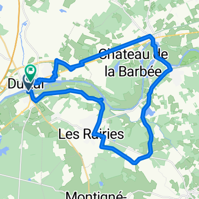
A cycling route starting in Durtal, Pays de la Loire Region, France.
Overview
About this route
- -:--
- Duration
- 200 km
- Distance
- 516 m
- Ascent
- 503 m
- Descent
- ---
- Avg. speed
- ---
- Max. altitude
Continue with Bikemap
Use, edit, or download this cycling route
You would like to ride R2TR Day 3 or customize it for your own trip? Here is what you can do with this Bikemap route:
Free features
- Save this route as favorite or in collections
- Copy & plan your own version of this route
- Split it into stages to create a multi-day tour
- Sync your route with Garmin or Wahoo
Premium features
Free trial for 3 days, or one-time payment. More about Bikemap Premium.
- Navigate this route on iOS & Android
- Export a GPX / KML file of this route
- Create your custom printout (try it for free)
- Download this route for offline navigation
Discover more Premium features.
Get Bikemap PremiumFrom our community
Other popular routes starting in Durtal
 De Rue de Sainte-Catherine 6, Huillé-Lézigné à Rue Pierre le Loyer 21, Huillé-Lézigné
- Distance
- 37.3 km
- Ascent
- 139 m
- Descent
- 161 m
- Location
- Durtal, Pays de la Loire Region, France
 De Rue du Mal Leclerc à Rue du Mal Leclerc
- Distance
- 24.5 km
- Ascent
- 63 m
- Descent
- 61 m
- Location
- Durtal, Pays de la Loire Region, France
 B/F Durtal - Le Lude
- Distance
- 34.7 km
- Ascent
- 208 m
- Descent
- 175 m
- Location
- Durtal, Pays de la Loire Region, France
 Itinéraire modéré en La Chapelle-d'Aligné
- Distance
- 22.3 km
- Ascent
- 103 m
- Descent
- 102 m
- Location
- Durtal, Pays de la Loire Region, France
 Relaxed route in La Flèche
- Distance
- 22.4 km
- Ascent
- 248 m
- Descent
- 245 m
- Location
- Durtal, Pays de la Loire Region, France
 / Durtal -Allones / Le Mans /.
- Distance
- 207.9 km
- Ascent
- 536 m
- Descent
- 429 m
- Location
- Durtal, Pays de la Loire Region, France
 De Rue Pierre le Loyer 23, Huillé-Lézigné à Rue Pierre le Loyer 23, Huillé-Lézigné
- Distance
- 15.6 km
- Ascent
- 211 m
- Descent
- 225 m
- Location
- Durtal, Pays de la Loire Region, France
 De Avenue d'Angers 6, Durtal à Pont de la Basse Chaîne, Angers
- Distance
- 57.5 km
- Ascent
- 330 m
- Descent
- 332 m
- Location
- Durtal, Pays de la Loire Region, France
Open it in the app