
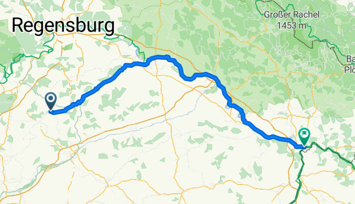
Rottenburg-Passau
A cycling route starting in Rottenburg an der Laaber, Bavaria, Germany.
Overview
About this route
- -:--
- Duration
- 146.7 km
- Distance
- 92 m
- Ascent
- 228 m
- Descent
- ---
- Avg. speed
- ---
- Max. altitude

Route quality
Waytypes & surfaces along the route
Waytypes
Track
41.1 km
(28 %)
Path
33.8 km
(23 %)
Surfaces
Paved
99.8 km
(68 %)
Unpaved
23.5 km
(16 %)
Asphalt
98.3 km
(67 %)
Gravel
11.7 km
(8 %)
Continue with Bikemap
Use, edit, or download this cycling route
You would like to ride Rottenburg-Passau or customize it for your own trip? Here is what you can do with this Bikemap route:
Free features
- Save this route as favorite or in collections
- Copy & plan your own version of this route
- Split it into stages to create a multi-day tour
- Sync your route with Garmin or Wahoo
Premium features
Free trial for 3 days, or one-time payment. More about Bikemap Premium.
- Navigate this route on iOS & Android
- Export a GPX / KML file of this route
- Create your custom printout (try it for free)
- Download this route for offline navigation
Discover more Premium features.
Get Bikemap PremiumFrom our community
Other popular routes starting in Rottenburg an der Laaber
 Rottenburg-Passau
- Distance
- 146.7 km
- Ascent
- 92 m
- Descent
- 228 m
- Location
- Rottenburg an der Laaber, Bavaria, Germany
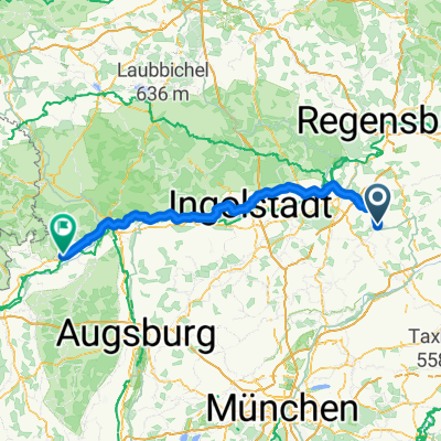 Rottenburg an der Laaber - Höchstädt an der Donau
- Distance
- 144.4 km
- Ascent
- 692 m
- Descent
- 690 m
- Location
- Rottenburg an der Laaber, Bavaria, Germany
 Berlin Vittorio day 7
- Distance
- 114.6 km
- Ascent
- 249 m
- Descent
- 167 m
- Location
- Rottenburg an der Laaber, Bavaria, Germany
 Von Patt nach Neu nach Ergolsbach nach patt
- Distance
- 46.8 km
- Ascent
- 359 m
- Descent
- 358 m
- Location
- Rottenburg an der Laaber, Bavaria, Germany
 Volksbadstraße nach Rathausplatz
- Distance
- 183.2 km
- Ascent
- 1,802 m
- Descent
- 1,815 m
- Location
- Rottenburg an der Laaber, Bavaria, Germany
 Landshuter Straße 38, Rottenburg an der Laaber nach Landshuter Straße 40, Rottenburg an der Laaber
- Distance
- 21.8 km
- Ascent
- 259 m
- Descent
- 260 m
- Location
- Rottenburg an der Laaber, Bavaria, Germany
 Von Oberhatzkofen nach Moosinning
- Distance
- 62.7 km
- Ascent
- 396 m
- Descent
- 378 m
- Location
- Rottenburg an der Laaber, Bavaria, Germany
 Rottenburg - Biburg
- Distance
- 59.2 km
- Ascent
- 436 m
- Descent
- 436 m
- Location
- Rottenburg an der Laaber, Bavaria, Germany
Open it in the app