

Annecy'10/Tour2: Granier + Cucheron
A cycling route starting in Jacob-Bellecombette, Auvergne-Rhône-Alpes, France.
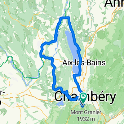
Overview
About this route
zwischen Grenoble und Chambéry liegt am Westrand der Savoyer Alpen das Massif der Chantreuse, welcher ich mit Domi und Philipp meinen Antrittsbesuch abstatte.
- -:--
- Duration
- 75.5 km
- Distance
- 1,595 m
- Ascent
- 1,590 m
- Descent
- ---
- Avg. speed
- ---
- Max. altitude

Continue with Bikemap
Use, edit, or download this cycling route
You would like to ride Annecy'10/Tour2: Granier + Cucheron or customize it for your own trip? Here is what you can do with this Bikemap route:
Free features
- Save this route as favorite or in collections
- Copy & plan your own version of this route
- Sync your route with Garmin or Wahoo
Premium features
Free trial for 3 days, or one-time payment. More about Bikemap Premium.
- Navigate this route on iOS & Android
- Export a GPX / KML file of this route
- Create your custom printout (try it for free)
- Download this route for offline navigation
Discover more Premium features.
Get Bikemap PremiumFrom our community
Other popular routes starting in Jacob-Bellecombette
 essais chamoux
- Distance
- 10.9 km
- Ascent
- 182 m
- Descent
- 185 m
- Location
- Jacob-Bellecombette, Auvergne-Rhône-Alpes, France
 Col du Granier - Cluse - Egaux
- Distance
- 51.7 km
- Ascent
- 1,249 m
- Descent
- 1,248 m
- Location
- Jacob-Bellecombette, Auvergne-Rhône-Alpes, France
 ESSAIS MR
- Distance
- 11.2 km
- Ascent
- 398 m
- Descent
- 343 m
- Location
- Jacob-Bellecombette, Auvergne-Rhône-Alpes, France
 R1 test
- Distance
- 121.7 km
- Ascent
- 1,203 m
- Descent
- 1,275 m
- Location
- Jacob-Bellecombette, Auvergne-Rhône-Alpes, France
 178–300 Faubourg Mâche, Chambéry à 7 Avenue Victoria, Aix-les-Bains
- Distance
- 21 km
- Ascent
- 100 m
- Descent
- 123 m
- Location
- Jacob-Bellecombette, Auvergne-Rhône-Alpes, France
 BALCONS CHARTREUSE LAC BOURGET
- Distance
- 61.9 km
- Ascent
- 1,160 m
- Descent
- 969 m
- Location
- Jacob-Bellecombette, Auvergne-Rhône-Alpes, France
 chambery saint etienne
- Distance
- 156.5 km
- Ascent
- 1,502 m
- Descent
- 1,523 m
- Location
- Jacob-Bellecombette, Auvergne-Rhône-Alpes, France
 boucle col du granier
- Distance
- 34.3 km
- Ascent
- 946 m
- Descent
- 951 m
- Location
- Jacob-Bellecombette, Auvergne-Rhône-Alpes, France
Open it in the app