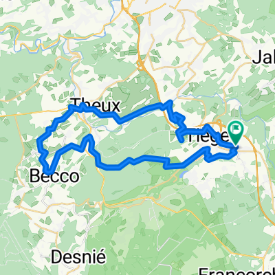
Drie rivieren Solwaster Ardennen België 12 of 15km
A cycling route starting in Jalhay, Wallonia, Belgium.
Overview
About this route
A beautiful walk around the village of Solwaster through the river valleys of the Hoegne, Statte and Hawe that spring from the marshy area of the High Fens. You walk a lot over narrow wooden bridges. The route is 15 km long and can be shortened to 12 km. There are over 300 meters of elevation to overcome. Start: Roquez 49 4845 Jalhay Belgium (N50.50800° E5.96053°)
- 3 h 53 min
- Duration
- 14.9 km
- Distance
- 310 m
- Ascent
- 310 m
- Descent
- 3.8 km/h
- Avg. speed
- ---
- Max. altitude
Continue with Bikemap
Use, edit, or download this cycling route
You would like to ride Drie rivieren Solwaster Ardennen België 12 of 15km or customize it for your own trip? Here is what you can do with this Bikemap route:
Free features
- Save this route as favorite or in collections
- Copy & plan your own version of this route
- Sync your route with Garmin or Wahoo
Premium features
Free trial for 3 days, or one-time payment. More about Bikemap Premium.
- Navigate this route on iOS & Android
- Export a GPX / KML file of this route
- Create your custom printout (try it for free)
- Download this route for offline navigation
Discover more Premium features.
Get Bikemap PremiumFrom our community
Other popular routes starting in Jalhay
- eupenroute
- Distance
- 118.3 km
- Ascent
- 1,239 m
- Descent
- 1,236 m
- Location
- Jalhay, Wallonia, Belgium
- The Valley of the Hoegne
- Distance
- 10.1 km
- Ascent
- 370 m
- Descent
- 368 m
- Location
- Jalhay, Wallonia, Belgium
- Foyr - Botrange gravel loop
- Distance
- 53.3 km
- Ascent
- 942 m
- Descent
- 941 m
- Location
- Jalhay, Wallonia, Belgium
- Baraque Michel - Das Land von oben betrachtet
- Distance
- 14.1 km
- Ascent
- 166 m
- Descent
- 166 m
- Location
- Jalhay, Wallonia, Belgium
- Drie rivieren Solwaster Ardennen België 12 of 15km
- Distance
- 14.9 km
- Ascent
- 310 m
- Descent
- 310 m
- Location
- Jalhay, Wallonia, Belgium
- Wandelen rond de Hoëgne
- Distance
- 7.4 km
- Ascent
- 204 m
- Descent
- 204 m
- Location
- Jalhay, Wallonia, Belgium
- rondje wtc de slinge
- Distance
- 118.1 km
- Ascent
- 1,422 m
- Descent
- 1,419 m
- Location
- Jalhay, Wallonia, Belgium
- Jalhay - La Hoegne - Fays - Jehanster
- Distance
- 29.6 km
- Ascent
- 439 m
- Descent
- 439 m
- Location
- Jalhay, Wallonia, Belgium
Open it in the app