

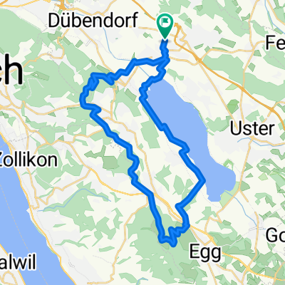
Zimikon-Winterberg-Wülflingen-Kolbrunn-Zimikon
A cycling route starting in Hegnau / Dammboden-Grindel, Canton of Zurich, Switzerland.
Overview
About this route
- -:--
- Duration
- 47.6 km
- Distance
- 446 m
- Ascent
- 446 m
- Descent
- ---
- Avg. speed
- ---
- Max. altitude
Route quality
Waytypes & surfaces along the route
Waytypes
Road
22.9 km
(48 %)
Quiet road
6.7 km
(14 %)
Surfaces
Paved
44.3 km
(93 %)
Unpaved
0.5 km
(1 %)
Asphalt
44.3 km
(93 %)
Gravel
0.5 km
(1 %)
Undefined
2.9 km
(6 %)
Continue with Bikemap
Use, edit, or download this cycling route
You would like to ride Zimikon-Winterberg-Wülflingen-Kolbrunn-Zimikon or customize it for your own trip? Here is what you can do with this Bikemap route:
Free features
- Save this route as favorite or in collections
- Copy & plan your own version of this route
- Sync your route with Garmin or Wahoo
Premium features
Free trial for 3 days, or one-time payment. More about Bikemap Premium.
- Navigate this route on iOS & Android
- Export a GPX / KML file of this route
- Create your custom printout (try it for free)
- Download this route for offline navigation
Discover more Premium features.
Get Bikemap PremiumFrom our community
Other popular routes starting in Hegnau / Dammboden-Grindel
 AirportZurich
- Distance
- 54.9 km
- Ascent
- 104 m
- Descent
- 104 m
- Location
- Hegnau / Dammboden-Grindel, Canton of Zurich, Switzerland
 Über den Vord. Guldenen
- Distance
- 31.7 km
- Ascent
- 473 m
- Descent
- 474 m
- Location
- Hegnau / Dammboden-Grindel, Canton of Zurich, Switzerland
 Greifensee
- Distance
- 22.5 km
- Ascent
- 72 m
- Descent
- 74 m
- Location
- Hegnau / Dammboden-Grindel, Canton of Zurich, Switzerland
 Effretikon-Sennhof-Theilingen-Uster
- Distance
- 44.6 km
- Ascent
- 448 m
- Descent
- 448 m
- Location
- Hegnau / Dammboden-Grindel, Canton of Zurich, Switzerland
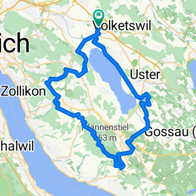 Auf den Pfannenstiel
- Distance
- 44.2 km
- Ascent
- 589 m
- Descent
- 590 m
- Location
- Hegnau / Dammboden-Grindel, Canton of Zurich, Switzerland
 Gemeindegrenze Volketswil
- Distance
- 32.5 km
- Ascent
- 471 m
- Descent
- 471 m
- Location
- Hegnau / Dammboden-Grindel, Canton of Zurich, Switzerland
 Kyburg
- Distance
- 45.8 km
- Ascent
- 460 m
- Descent
- 459 m
- Location
- Hegnau / Dammboden-Grindel, Canton of Zurich, Switzerland
 Auf den Bachtel
- Distance
- 61.3 km
- Ascent
- 770 m
- Descent
- 770 m
- Location
- Hegnau / Dammboden-Grindel, Canton of Zurich, Switzerland
Open it in the app