

Unnamed Road, Vanyola nach Unnamed Road, Vanyola
A cycling route starting in Bakonyszentlászló, Győr-Moson-Sopron, Hungary.
Overview
About this route
- 4 min
- Duration
- 2.3 km
- Distance
- 9 m
- Ascent
- 17 m
- Descent
- 37.8 km/h
- Avg. speed
- ---
- Max. altitude

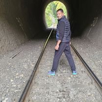
Route photos

Continue with Bikemap
Use, edit, or download this cycling route
You would like to ride Unnamed Road, Vanyola nach Unnamed Road, Vanyola or customize it for your own trip? Here is what you can do with this Bikemap route:
Free features
- Save this route as favorite or in collections
- Copy & plan your own version of this route
- Sync your route with Garmin or Wahoo
Premium features
Free trial for 3 days, or one-time payment. More about Bikemap Premium.
- Navigate this route on iOS & Android
- Export a GPX / KML file of this route
- Create your custom printout (try it for free)
- Download this route for offline navigation
Discover more Premium features.
Get Bikemap PremiumFrom our community
Other popular routes starting in Bakonyszentlászló
 Vinye_Kőrishegy_Szépalmapuszta_Borzavár_Porvacsesznek_Vinye
- Distance
- 28.8 km
- Ascent
- 382 m
- Descent
- 378 m
- Location
- Bakonyszentlászló, Győr-Moson-Sopron, Hungary
 bakonyi kör
- Distance
- 55.5 km
- Ascent
- 474 m
- Descent
- 467 m
- Location
- Bakonyszentlászló, Győr-Moson-Sopron, Hungary
 Unnamed Road, Vanyola nach Unnamed Road, Vanyola
- Distance
- 2.3 km
- Ascent
- 9 m
- Descent
- 17 m
- Location
- Bakonyszentlászló, Győr-Moson-Sopron, Hungary
 Bakony: Ördög-árok, Csesznek, Kőrárok
- Distance
- 56 km
- Ascent
- 865 m
- Descent
- 865 m
- Location
- Bakonyszentlászló, Győr-Moson-Sopron, Hungary
 Bakony edzés alternatív
- Distance
- 77.9 km
- Ascent
- 730 m
- Descent
- 730 m
- Location
- Bakonyszentlászló, Győr-Moson-Sopron, Hungary
 Cuha Light
- Distance
- 16.4 km
- Ascent
- 383 m
- Descent
- 385 m
- Location
- Bakonyszentlászló, Győr-Moson-Sopron, Hungary
 Vinye - Vinye
- Distance
- 19.6 km
- Ascent
- 522 m
- Descent
- 545 m
- Location
- Bakonyszentlászló, Győr-Moson-Sopron, Hungary
 Farkas hegy, Pápateszér to Farkas hegy, Pápateszér
- Distance
- 21.9 km
- Ascent
- 340 m
- Descent
- 337 m
- Location
- Bakonyszentlászló, Győr-Moson-Sopron, Hungary
Open it in the app