Südstadt-Stadtwald
A cycling route starting in Bayenthal, North Rhine-Westphalia, Germany.
Overview
About this route
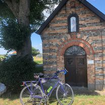
From the southern district of Cologne, past the Aachen pond into the city forest
- -:--
- Duration
- 8.5 km
- Distance
- 19 m
- Ascent
- 16 m
- Descent
- ---
- Avg. speed
- 68 m
- Max. altitude
Route quality
Waytypes & surfaces along the route
Waytypes
Path
5.4 km
(63 %)
Quiet road
2.6 km
(31 %)
Surfaces
Paved
6 km
(70 %)
Unpaved
1.5 km
(18 %)
Asphalt
6 km
(70 %)
Gravel
1.5 km
(18 %)
Undefined
1 km
(12 %)
Route highlights
Points of interest along the route
Point of interest after 6.9 km
<a href="http://www.amares-koeln.de/">Amares</a>, Waldkindergarten und Naturerlebnis für Kinder
Continue with Bikemap
Use, edit, or download this cycling route
You would like to ride Südstadt-Stadtwald or customize it for your own trip? Here is what you can do with this Bikemap route:
Free features
- Save this route as favorite or in collections
- Copy & plan your own version of this route
- Sync your route with Garmin or Wahoo
Premium features
Free trial for 3 days, or one-time payment. More about Bikemap Premium.
- Navigate this route on iOS & Android
- Export a GPX / KML file of this route
- Create your custom printout (try it for free)
- Download this route for offline navigation
Discover more Premium features.
Get Bikemap PremiumFrom our community
Other popular routes starting in Bayenthal
- Eifeltour
- Distance
- 106.9 km
- Ascent
- 687 m
- Descent
- 639 m
- Location
- Bayenthal, North Rhine-Westphalia, Germany
- Tante Ottos Premiere 04.08.2019
- Distance
- 67.6 km
- Ascent
- 1,414 m
- Descent
- 1,411 m
- Location
- Bayenthal, North Rhine-Westphalia, Germany
- Um die Dhünntalsperre
- Distance
- 91.9 km
- Ascent
- 884 m
- Descent
- 876 m
- Location
- Bayenthal, North Rhine-Westphalia, Germany
- Köln-Dransdorf-Heimerzheim-Brühl-Köln
- Distance
- 79.6 km
- Ascent
- 252 m
- Descent
- 252 m
- Location
- Bayenthal, North Rhine-Westphalia, Germany
- Bei 30° und Ostwind nach drüben
- Distance
- 55.7 km
- Ascent
- 144 m
- Descent
- 146 m
- Location
- Bayenthal, North Rhine-Westphalia, Germany
- Dubi 19_3
- Distance
- 21 km
- Ascent
- 62 m
- Descent
- 60 m
- Location
- Bayenthal, North Rhine-Westphalia, Germany
- Hürth- Kalscheuren
- Distance
- 19.9 km
- Ascent
- 51 m
- Descent
- 51 m
- Location
- Bayenthal, North Rhine-Westphalia, Germany
- So., 28. 07. 2019
- Distance
- 46.1 km
- Ascent
- 59 m
- Descent
- 59 m
- Location
- Bayenthal, North Rhine-Westphalia, Germany
Open it in the app