

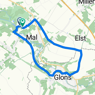
After Coronarit
A cycling route starting in Tongeren, Flemish Region, Belgium.
Overview
About this route
- -:--
- Duration
- 57.7 km
- Distance
- 252 m
- Ascent
- 253 m
- Descent
- ---
- Avg. speed
- ---
- Max. altitude

Route quality
Waytypes & surfaces along the route
Waytypes
Road
26.6 km
(46 %)
Quiet road
10.4 km
(18 %)
Surfaces
Paved
27.7 km
(48 %)
Asphalt
23.1 km
(40 %)
Concrete
4.6 km
(8 %)
Undefined
30 km
(52 %)
Continue with Bikemap
Use, edit, or download this cycling route
You would like to ride After Coronarit or customize it for your own trip? Here is what you can do with this Bikemap route:
Free features
- Save this route as favorite or in collections
- Copy & plan your own version of this route
- Sync your route with Garmin or Wahoo
Premium features
Free trial for 3 days, or one-time payment. More about Bikemap Premium.
- Navigate this route on iOS & Android
- Export a GPX / KML file of this route
- Create your custom printout (try it for free)
- Download this route for offline navigation
Discover more Premium features.
Get Bikemap PremiumFrom our community
Other popular routes starting in Tongeren
 10km_Mal
- Distance
- 10 km
- Ascent
- 73 m
- Descent
- 74 m
- Location
- Tongeren, Flemish Region, Belgium
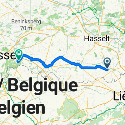 Von Tongern bis Löwen
- Distance
- 63.6 km
- Ascent
- 286 m
- Descent
- 279 m
- Location
- Tongeren, Flemish Region, Belgium
 2020 4SB Rit Rondje Riemst
- Distance
- 61 km
- Ascent
- 266 m
- Descent
- 266 m
- Location
- Tongeren, Flemish Region, Belgium
 4SB RIT Oost-Maarland 55km
- Distance
- 56.1 km
- Ascent
- 175 m
- Descent
- 175 m
- Location
- Tongeren, Flemish Region, Belgium
 After Coronarit
- Distance
- 57.7 km
- Ascent
- 252 m
- Descent
- 253 m
- Location
- Tongeren, Flemish Region, Belgium
 4SB Rit Zutendaal 50km
- Distance
- 51.7 km
- Ascent
- 212 m
- Descent
- 209 m
- Location
- Tongeren, Flemish Region, Belgium
 90_Neffie
- Distance
- 89.2 km
- Ascent
- 1,228 m
- Descent
- 744 m
- Location
- Tongeren, Flemish Region, Belgium
 Limburg's mooiste 52 km
- Distance
- 52 km
- Ascent
- 231 m
- Descent
- 229 m
- Location
- Tongeren, Flemish Region, Belgium
Open it in the app