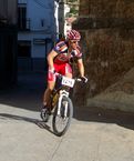
TOUR de la SUBBETICA
A cycling route starting in Doña Mencía, Andalusia, Spain.
Overview
About this route
This is a route where most of the roads are secondary and which delve into the heart of the Subbetica among its incredible mountain ranges and villages.
Surface: Practically perfect
Distance: 125 km
Difficulty: Medium-High
Water refill points: Cabra, Priego, Junction with greenway near Zuheros.
Points of interest: Zagrilla, Fuente Tojar, Carcabuey, Zuheros and Doña Mencia
- -:--
- Duration
- 124.8 km
- Distance
- 1,196 m
- Ascent
- 1,198 m
- Descent
- ---
- Avg. speed
- ---
- Max. altitude
Route quality
Waytypes & surfaces along the route
Waytypes
Road
57.4 km
(46 %)
Cycleway
22.5 km
(18 %)
Surfaces
Paved
46.2 km
(37 %)
Asphalt
46.2 km
(37 %)
Undefined
78.6 km
(63 %)
Continue with Bikemap
Use, edit, or download this cycling route
You would like to ride TOUR de la SUBBETICA or customize it for your own trip? Here is what you can do with this Bikemap route:
Free features
- Save this route as favorite or in collections
- Copy & plan your own version of this route
- Split it into stages to create a multi-day tour
- Sync your route with Garmin or Wahoo
Premium features
Free trial for 3 days, or one-time payment. More about Bikemap Premium.
- Navigate this route on iOS & Android
- Export a GPX / KML file of this route
- Create your custom printout (try it for free)
- Download this route for offline navigation
Discover more Premium features.
Get Bikemap PremiumFrom our community
Other popular routes starting in Doña Mencía
 Dag 8 ronde van andalusie
- Distance
- 77 km
- Ascent
- 494 m
- Descent
- 546 m
- Location
- Doña Mencía, Andalusia, Spain
 Doña Mencia,Cabra,ermita de La virgen de la Sierra,La Nava,Barranco del bailon,Zuheros,Doña Mencia
- Distance
- 37.1 km
- Ascent
- 812 m
- Descent
- 812 m
- Location
- Doña Mencía, Andalusia, Spain
 TOUR de la SUBBETICA
- Distance
- 124.8 km
- Ascent
- 1,196 m
- Descent
- 1,198 m
- Location
- Doña Mencía, Andalusia, Spain
 Circular por Doña Mencía 22-11-20
- Distance
- 24.7 km
- Ascent
- 678 m
- Descent
- 678 m
- Location
- Doña Mencía, Andalusia, Spain
 Doña Mencia a Cabra por la vía verde
- Distance
- 18.5 km
- Ascent
- 290 m
- Descent
- 277 m
- Location
- Doña Mencía, Andalusia, Spain
 Ruta A- Dia 14-5
- Distance
- 34.6 km
- Ascent
- 662 m
- Descent
- 658 m
- Location
- Doña Mencía, Andalusia, Spain
 Zuheros to Jaen
- Distance
- 90.3 km
- Ascent
- 416 m
- Descent
- 623 m
- Location
- Doña Mencía, Andalusia, Spain
 Via Verde de la Subbetica
- Distance
- 53.8 km
- Ascent
- 423 m
- Descent
- 423 m
- Location
- Doña Mencía, Andalusia, Spain
Open it in the app


