

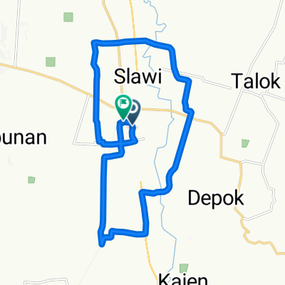
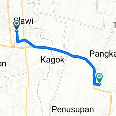
Jalan Griya Tiara Arum 2 25, Kecamatan Slawi to Unnamed Road, Kecamatan Balapulang
A cycling route starting in Slawi, Central Java, Indonesia.
Overview
About this route
- -:--
- Duration
- 13.2 km
- Distance
- 258 m
- Ascent
- 38 m
- Descent
- ---
- Avg. speed
- ---
- Max. altitude

Route photos

Route quality
Waytypes & surfaces along the route
Waytypes
Quiet road
12.1 km
(92 %)
Road
1 km
(8 %)
Undefined
0 km
(<1 %)
Continue with Bikemap
Use, edit, or download this cycling route
You would like to ride Jalan Griya Tiara Arum 2 25, Kecamatan Slawi to Unnamed Road, Kecamatan Balapulang or customize it for your own trip? Here is what you can do with this Bikemap route:
Free features
- Save this route as favorite or in collections
- Copy & plan your own version of this route
- Sync your route with Garmin or Wahoo
Premium features
Free trial for 3 days, or one-time payment. More about Bikemap Premium.
- Navigate this route on iOS & Android
- Export a GPX / KML file of this route
- Create your custom printout (try it for free)
- Download this route for offline navigation
Discover more Premium features.
Get Bikemap PremiumFrom our community
Other popular routes starting in Slawi
 Night Ride
- Distance
- 27.4 km
- Ascent
- 48 m
- Descent
- 72 m
- Location
- Slawi, Central Java, Indonesia
 Jalan KH. Mas Mansyur F50, Kecamatan Slawi to Jalan Merpati 1, Kecamatan Slawi
- Distance
- 22.7 km
- Ascent
- 102 m
- Descent
- 101 m
- Location
- Slawi, Central Java, Indonesia
 Jalan KH. Mas Mansyur F50, Kecamatan Slawi to Jalan Merpati 1, Kecamatan Slawi
- Distance
- 29.2 km
- Ascent
- 138 m
- Descent
- 138 m
- Location
- Slawi, Central Java, Indonesia
 Jalan KH. Mas Mansyur F50, Kecamatan Slawi to Jalan Merpati 1, Kecamatan Slawi
- Distance
- 26.4 km
- Ascent
- 151 m
- Descent
- 147 m
- Location
- Slawi, Central Java, Indonesia
 Gang 30, Kecamatan Slawi to Jalan Tengah, Kecamatan Pangkah
- Distance
- 4.7 km
- Ascent
- 24 m
- Descent
- 37 m
- Location
- Slawi, Central Java, Indonesia
 Jalan Gajah Mada 69, Kecamatan Slawi to Jalan Gajah Mada No.69, Kecamatan Slawi
- Distance
- 10.5 km
- Ascent
- 31 m
- Descent
- 25 m
- Location
- Slawi, Central Java, Indonesia
 Night Ride
- Distance
- 36.8 km
- Ascent
- 105 m
- Descent
- 126 m
- Location
- Slawi, Central Java, Indonesia
 24CQ+7R8, Kecamatan Slawi to Jalan Jenderal Ahmad Yani No.184, Kecamatan Slawi
- Distance
- 49.1 km
- Ascent
- 432 m
- Descent
- 430 m
- Location
- Slawi, Central Java, Indonesia
Open it in the app