

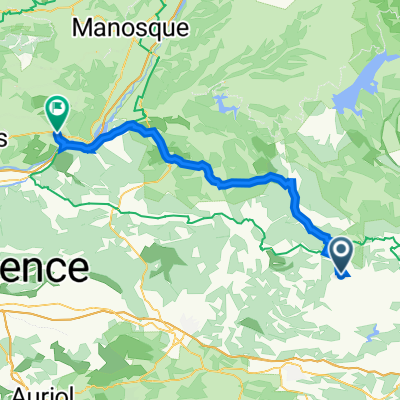
cotignac
A cycling route starting in Cotignac, Provence-Alpes-Côte d'Azur Region, France.
Overview
About this route
- -:--
- Duration
- 84.6 km
- Distance
- 1,019 m
- Ascent
- 1,021 m
- Descent
- ---
- Avg. speed
- ---
- Max. altitude
Continue with Bikemap
Use, edit, or download this cycling route
You would like to ride cotignac or customize it for your own trip? Here is what you can do with this Bikemap route:
Free features
- Save this route as favorite or in collections
- Copy & plan your own version of this route
- Split it into stages to create a multi-day tour
- Sync your route with Garmin or Wahoo
Premium features
Free trial for 3 days, or one-time payment. More about Bikemap Premium.
- Navigate this route on iOS & Android
- Export a GPX / KML file of this route
- Create your custom printout (try it for free)
- Download this route for offline navigation
Discover more Premium features.
Get Bikemap PremiumFrom our community
Other popular routes starting in Cotignac
 Route d'Entrecasteaux 3831, Cotignac nach Chemin de Pecounillier 4044, Cotignac
- Distance
- 30.9 km
- Ascent
- 1,177 m
- Descent
- 1,176 m
- Location
- Cotignac, Provence-Alpes-Côte d'Azur Region, France
 Z Horní Provance na Azurové pobřeží - 8. den
- Distance
- 45.8 km
- Ascent
- 359 m
- Descent
- 533 m
- Location
- Cotignac, Provence-Alpes-Côte d'Azur Region, France
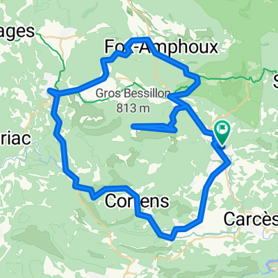
 Bessillon round
- Distance
- 50.1 km
- Ascent
- 405 m
- Descent
- 405 m
- Location
- Cotignac, Provence-Alpes-Côte d'Azur Region, France
 Petit tour du matin en vacs
- Distance
- 34.5 km
- Ascent
- 435 m
- Descent
- 436 m
- Location
- Cotignac, Provence-Alpes-Côte d'Azur Region, France
 J6B RC2 MIPIM 2018
- Distance
- 60.4 km
- Ascent
- 659 m
- Descent
- 771 m
- Location
- Cotignac, Provence-Alpes-Côte d'Azur Region, France
 De Cours Gambetta 5, Cotignac à Place de la Liberte 2, Mirabeau
- Distance
- 63.8 km
- Ascent
- 1,095 m
- Descent
- 998 m
- Location
- Cotignac, Provence-Alpes-Côte d'Azur Region, France
 Tour par les falaise de Château-vert
- Distance
- 49.1 km
- Ascent
- 366 m
- Descent
- 369 m
- Location
- Cotignac, Provence-Alpes-Côte d'Azur Region, France
 Cotignac 66
- Distance
- 66.4 km
- Ascent
- 843 m
- Descent
- 844 m
- Location
- Cotignac, Provence-Alpes-Côte d'Azur Region, France
Open it in the app