

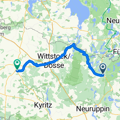
Easy ride in Rheinsberg
A cycling route starting in Rheinsberg, Brandenburg, Germany.
Overview
About this route
- 2 h 6 min
- Duration
- 18.8 km
- Distance
- 168 m
- Ascent
- 164 m
- Descent
- 8.9 km/h
- Avg. speed
- ---
- Max. altitude
Continue with Bikemap
Use, edit, or download this cycling route
You would like to ride Easy ride in Rheinsberg or customize it for your own trip? Here is what you can do with this Bikemap route:
Free features
- Save this route as favorite or in collections
- Copy & plan your own version of this route
- Sync your route with Garmin or Wahoo
Premium features
Free trial for 3 days, or one-time payment. More about Bikemap Premium.
- Navigate this route on iOS & Android
- Export a GPX / KML file of this route
- Create your custom printout (try it for free)
- Download this route for offline navigation
Discover more Premium features.
Get Bikemap PremiumFrom our community
Other popular routes starting in Rheinsberg
 Rheinsberg
- Distance
- 66.8 km
- Ascent
- 245 m
- Descent
- 240 m
- Location
- Rheinsberg, Brandenburg, Germany
 Rheinsberg - Zechlinerhütte - Rheinsberg
- Distance
- 30.5 km
- Ascent
- 144 m
- Descent
- 139 m
- Location
- Rheinsberg, Brandenburg, Germany
 Seestraße 5A nach Seestraße 5A
- Distance
- 32.3 km
- Ascent
- 223 m
- Descent
- 222 m
- Location
- Rheinsberg, Brandenburg, Germany
 rund um den stechlin
- Distance
- 57.6 km
- Ascent
- 258 m
- Descent
- 252 m
- Location
- Rheinsberg, Brandenburg, Germany
 Sechsseenrunde
- Distance
- 63.7 km
- Ascent
- 372 m
- Descent
- 351 m
- Location
- Rheinsberg, Brandenburg, Germany
 Plau am See nach Zechlinerhütte
- Distance
- 93.3 km
- Ascent
- 301 m
- Descent
- 286 m
- Location
- Rheinsberg, Brandenburg, Germany
 tour 2025 3.Etappe Pritzwalk
- Distance
- 71.1 km
- Ascent
- 387 m
- Descent
- 357 m
- Location
- Rheinsberg, Brandenburg, Germany
 Easy Mittwoch Course In Rheinsberg
- Distance
- 6.6 km
- Ascent
- 274 m
- Descent
- 283 m
- Location
- Rheinsberg, Brandenburg, Germany
Open it in the app