

New Freedom Low Elevation Loop
A cycling route starting in New Freedom, Pennsylvania, United States.
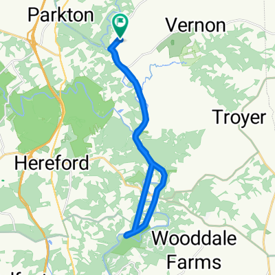
Overview
About this route
Very few hills.
- -:--
- Duration
- 45.2 km
- Distance
- 283 m
- Ascent
- 283 m
- Descent
- ---
- Avg. speed
- ---
- Max. altitude
Route quality
Waytypes & surfaces along the route
Waytypes
Quiet road
17.2 km
(38 %)
Road
11.3 km
(25 %)
Surfaces
Paved
30.3 km
(67 %)
Asphalt
25.7 km
(57 %)
Paved (undefined)
4.5 km
(10 %)
Undefined
14.9 km
(33 %)
Continue with Bikemap
Use, edit, or download this cycling route
You would like to ride New Freedom Low Elevation Loop or customize it for your own trip? Here is what you can do with this Bikemap route:
Free features
- Save this route as favorite or in collections
- Copy & plan your own version of this route
- Sync your route with Garmin or Wahoo
Premium features
Free trial for 3 days, or one-time payment. More about Bikemap Premium.
- Navigate this route on iOS & Android
- Export a GPX / KML file of this route
- Create your custom printout (try it for free)
- Download this route for offline navigation
Discover more Premium features.
Get Bikemap PremiumFrom our community
Other popular routes starting in New Freedom
 Torrey C Brown Rail Trail, Parkton to Walker Rd, Parkton
- Distance
- 41.7 km
- Ascent
- 463 m
- Descent
- 469 m
- Location
- New Freedom, Pennsylvania, United States
 New Freedom Low Elevation Loop
- Distance
- 45.2 km
- Ascent
- 283 m
- Descent
- 283 m
- Location
- New Freedom, Pennsylvania, United States
 Maryland Cycling Classic, 1:00
- Distance
- 26.2 km
- Ascent
- 525 m
- Descent
- 528 m
- Location
- New Freedom, Pennsylvania, United States
 Hodle to BeeTree
- Distance
- 8 km
- Ascent
- 68 m
- Descent
- 140 m
- Location
- New Freedom, Pennsylvania, United States
 April 23
- Distance
- 18.9 km
- Ascent
- 285 m
- Descent
- 284 m
- Location
- New Freedom, Pennsylvania, United States
 Hodle to Kyles
- Distance
- 4.7 km
- Ascent
- 49 m
- Descent
- 88 m
- Location
- New Freedom, Pennsylvania, United States
 Heritage Rail Trail, New Freedom to Torrey C Brown Rail Trail, Monkton
- Distance
- 18 km
- Ascent
- 107 m
- Descent
- 263 m
- Location
- New Freedom, Pennsylvania, United States
 Moderate route
- Distance
- 13.6 km
- Ascent
- 145 m
- Descent
- 110 m
- Location
- New Freedom, Pennsylvania, United States
Open it in the app