Loop1
- 29.7 km
- 225 m
- 236 m
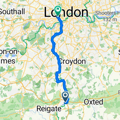
- Bletchingley, England, United Kingdom
A cycling route starting in Bletchingley, England, United Kingdom.
Overview
Start in Mercers Country Park
Via Lindfield for coffee @22 miles. Field & Forest, 43 High Street, Lindfield. RH16 2HN Lindfield Coffee Works, Unit 2, 70 High Street (Alma Road), Lindfield. RH16 2HL
Return: Tanhouse, Rusper Road, Newdigate, Dorking. RH5 5BX 2 pibs after that allegedly offer take away
created this 5 years ago
Route quality
Road
60 km
(45 %)
Quiet road
52 km
(39 %)
Paved
78.7 km
(59 %)
Asphalt
69.4 km
(52 %)
Paved (undefined)
9.3 km
(7 %)
Undefined
54.7 km
(41 %)
Continue with Bikemap
You would like to ride Merstham2Brighton & back or customize it for your own trip? Here is what you can do with this Bikemap route:
Free trial for 3 days, or one-time payment. More about Bikemap Premium.
Discover more Premium features.
Get Bikemap PremiumFrom our community
Open it in the app