

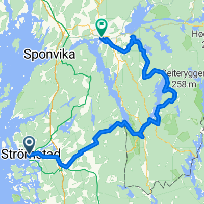
Grensereittet 2010
A cycling route starting in Strömstad, Västra Götaland County, Sweden.
Overview
About this route
- -:--
- Duration
- 76.5 km
- Distance
- 690 m
- Ascent
- 611 m
- Descent
- ---
- Avg. speed
- ---
- Max. altitude

Route quality
Waytypes & surfaces along the route
Waytypes
Quiet road
29.8 km
(39 %)
Access road
10.7 km
(14 %)
Surfaces
Paved
15.3 km
(20 %)
Unpaved
32.9 km
(43 %)
Gravel
30.6 km
(40 %)
Asphalt
12.2 km
(16 %)
Continue with Bikemap
Use, edit, or download this cycling route
You would like to ride Grensereittet 2010 or customize it for your own trip? Here is what you can do with this Bikemap route:
Free features
- Save this route as favorite or in collections
- Copy & plan your own version of this route
- Sync your route with Garmin or Wahoo
Premium features
Free trial for 3 days, or one-time payment. More about Bikemap Premium.
- Navigate this route on iOS & Android
- Export a GPX / KML file of this route
- Create your custom printout (try it for free)
- Download this route for offline navigation
Discover more Premium features.
Get Bikemap PremiumFrom our community
Other popular routes starting in Strömstad
 Grensereittet 2010
- Distance
- 76.5 km
- Ascent
- 690 m
- Descent
- 611 m
- Location
- Strömstad, Västra Götaland County, Sweden
 2005_5 Trondheim_Travemünde
- Distance
- 132 km
- Ascent
- 1,452 m
- Descent
- 1,449 m
- Location
- Strömstad, Västra Götaland County, Sweden
 Grenserittet - trening
- Distance
- 73.7 km
- Ascent
- 677 m
- Descent
- 587 m
- Location
- Strömstad, Västra Götaland County, Sweden
 Strømstad - Brastad
- Distance
- 97.3 km
- Ascent
- 1,037 m
- Descent
- 1,003 m
- Location
- Strömstad, Västra Götaland County, Sweden
 28_Strömstad-Lysekil_2016-07-22
- Distance
- 116 km
- Ascent
- 465 m
- Descent
- 479 m
- Location
- Strömstad, Västra Götaland County, Sweden
 Strömstad - Karlshus
- Distance
- 62.2 km
- Ascent
- 825 m
- Descent
- 834 m
- Location
- Strömstad, Västra Götaland County, Sweden
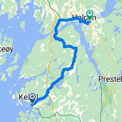 Laholmen, Strömstad to Vesleveien, Halden
- Distance
- 42.1 km
- Ascent
- 705 m
- Descent
- 636 m
- Location
- Strömstad, Västra Götaland County, Sweden
 Halden - Halden
- Distance
- 74 km
- Ascent
- 1,075 m
- Descent
- 1,078 m
- Location
- Strömstad, Västra Götaland County, Sweden
Open it in the app