

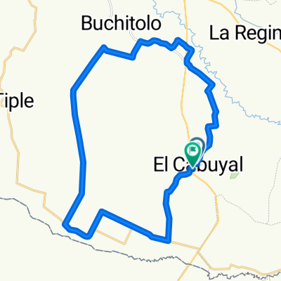
vía villa gorgona - buitrera
A cycling route starting in Candelaria, Valle del Cauca Department, Colombia.
Overview
About this route
- 3 h 8 min
- Duration
- 67.6 km
- Distance
- 495 m
- Ascent
- 496 m
- Descent
- 21.6 km/h
- Avg. speed
- ---
- Max. altitude

Continue with Bikemap
Use, edit, or download this cycling route
You would like to ride vía villa gorgona - buitrera or customize it for your own trip? Here is what you can do with this Bikemap route:
Free features
- Save this route as favorite or in collections
- Copy & plan your own version of this route
- Sync your route with Garmin or Wahoo
Premium features
Free trial for 3 days, or one-time payment. More about Bikemap Premium.
- Navigate this route on iOS & Android
- Export a GPX / KML file of this route
- Create your custom printout (try it for free)
- Download this route for offline navigation
Discover more Premium features.
Get Bikemap PremiumFrom our community
Other popular routes starting in Candelaria
 De Carrera 8ª 5-46 a Carrera 8ª 5-46
- Distance
- 29.9 km
- Ascent
- 27 m
- Descent
- 28 m
- Location
- Candelaria, Valle del Cauca Department, Colombia
 Paseo lento
- Distance
- 20.7 km
- Ascent
- 133 m
- Descent
- 172 m
- Location
- Candelaria, Valle del Cauca Department, Colombia
 De Calle 22a #14-09, Candelaria a Unnamed Road
- Distance
- 10.1 km
- Ascent
- 90 m
- Descent
- 63 m
- Location
- Candelaria, Valle del Cauca Department, Colombia
 De Carrera 4A a Calle 20A 11-15
- Distance
- 1.9 km
- Ascent
- 11 m
- Descent
- 18 m
- Location
- Candelaria, Valle del Cauca Department, Colombia
 De Calle 20A 11-15 a Carrera 9
- Distance
- 2.3 km
- Ascent
- 15 m
- Descent
- 54 m
- Location
- Candelaria, Valle del Cauca Department, Colombia
 vía villa gorgona - buitrera
- Distance
- 67.6 km
- Ascent
- 495 m
- Descent
- 496 m
- Location
- Candelaria, Valle del Cauca Department, Colombia
 De Carrera 10 19-65, Candelaria a Via a Fumicaña
- Distance
- 2.2 km
- Ascent
- 20 m
- Descent
- 22 m
- Location
- Candelaria, Valle del Cauca Department, Colombia
 De Calle 19 7-21 a ECO HOTEL EL CASTILLO
- Distance
- 32.4 km
- Ascent
- 445 m
- Descent
- 243 m
- Location
- Candelaria, Valle del Cauca Department, Colombia
Open it in the app