

Pour se faire les mollets au Nord-Ouest de Rouen
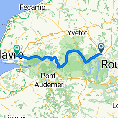
A cycling route starting in Roumare, Normandy, France.
Overview
About this route
Loop starting from Roumare, towards Duclair: green avenue from Duclair to Saint-Vandrille (the flattest part of the route).
For the rest, it's a succession of more or less steep climbs and descents.
Some sections are a bit more dangerous (due to motorists driving like lunatics) but overall it’s a lovely ride with open views, places in the forest...
For the green avenue, the section after Le Trait was not yet inaugurated at the time I rode the route (20/06/20) but it was possible to pass.
Rue des Monts in Duclair is one-way except for residents; it would deserve a 'except cyclists' to avoid a more dangerous road.
On the road to Barentin, there is the possibility of getting onto a path that seems to be pedestrian but leads nowhere. This allows for a quiet climb away from motorized vehicles, but in the wrong direction).
I did a variation loop that does not go through the vélorail path (gravelly path) but goes through a superb climb to the square! It’s up to you!
- -:--
- Duration
- 74 km
- Distance
- 815 m
- Ascent
- 816 m
- Descent
- ---
- Avg. speed
- ---
- Max. altitude
Route photos

Route quality
Waytypes & surfaces along the route
Waytypes
Road
34.8 km
(47 %)
Path
17 km
(23 %)
Surfaces
Paved
50.3 km
(68 %)
Unpaved
4.4 km
(6 %)
Asphalt
49.6 km
(67 %)
Ground
3.7 km
(5 %)
Continue with Bikemap
Use, edit, or download this cycling route
You would like to ride Pour se faire les mollets au Nord-Ouest de Rouen or customize it for your own trip? Here is what you can do with this Bikemap route:
Free features
- Save this route as favorite or in collections
- Copy & plan your own version of this route
- Sync your route with Garmin or Wahoo
Premium features
Free trial for 3 days, or one-time payment. More about Bikemap Premium.
- Navigate this route on iOS & Android
- Export a GPX / KML file of this route
- Create your custom printout (try it for free)
- Download this route for offline navigation
Discover more Premium features.
Get Bikemap PremiumFrom our community
Other popular routes starting in Roumare
 Pour se faire les mollets au Nord-Ouest de Rouen
- Distance
- 74 km
- Ascent
- 815 m
- Descent
- 816 m
- Location
- Roumare, Normandy, France
 Route des Deux Tilleuls, Roumare à Chemin du Marais, Duclair
- Distance
- 11 km
- Ascent
- 67 m
- Descent
- 197 m
- Location
- Roumare, Normandy, France
 Pour se faire les mollets au Nord-Ouest de Rouen (var)
- Distance
- 73.6 km
- Ascent
- 828 m
- Descent
- 829 m
- Location
- Roumare, Normandy, France
 A la campagne autour de Roumare
- Distance
- 35.4 km
- Ascent
- 365 m
- Descent
- 363 m
- Location
- Roumare, Normandy, France
 Roumare - Rogerville
- Distance
- 75.5 km
- Ascent
- 227 m
- Descent
- 344 m
- Location
- Roumare, Normandy, France
 Cyclotourisme à l'ouest de Canteleu
- Distance
- 75.3 km
- Ascent
- 860 m
- Descent
- 861 m
- Location
- Roumare, Normandy, France
 2DIves-sur-mer
- Distance
- 104.7 km
- Ascent
- 536 m
- Descent
- 645 m
- Location
- Roumare, Normandy, France
Open it in the app