

West Yorks Cobbled Classic 2
A cycling route starting in Oughtibridge, England, United Kingdom.
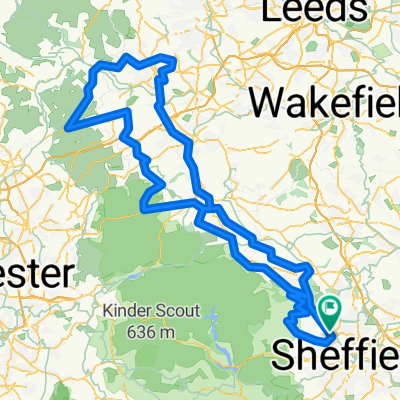
Overview
About this route
Trooper Lane, Shibden Wall, Gibb Lane, Old Lane, Cragg Vale, Ripponden Bank, Wessenden Head, Jackson Bridge
- -:--
- Duration
- 166 km
- Distance
- 1,974 m
- Ascent
- 1,976 m
- Descent
- ---
- Avg. speed
- ---
- Max. altitude

Route quality
Waytypes & surfaces along the route
Waytypes
Quiet road
76.9 km
(46 %)
Busy road
38.7 km
(23 %)
Surfaces
Paved
77.5 km
(47 %)
Unpaved
6.8 km
(4 %)
Asphalt
75.8 km
(46 %)
Gravel
5.6 km
(3 %)
Continue with Bikemap
Use, edit, or download this cycling route
You would like to ride West Yorks Cobbled Classic 2 or customize it for your own trip? Here is what you can do with this Bikemap route:
Free features
- Save this route as favorite or in collections
- Copy & plan your own version of this route
- Split it into stages to create a multi-day tour
- Sync your route with Garmin or Wahoo
Premium features
Free trial for 3 days, or one-time payment. More about Bikemap Premium.
- Navigate this route on iOS & Android
- Export a GPX / KML file of this route
- Create your custom printout (try it for free)
- Download this route for offline navigation
Discover more Premium features.
Get Bikemap PremiumFrom our community
Other popular routes starting in Oughtibridge
 JR Challenge
- Distance
- 67.2 km
- Ascent
- 956 m
- Descent
- 956 m
- Location
- Oughtibridge, England, United Kingdom
 Bradfield and Strines
- Distance
- 29.5 km
- Ascent
- 547 m
- Descent
- 524 m
- Location
- Oughtibridge, England, United Kingdom
 Ughill & Dungworth, Oughtibridge v2
- Distance
- 30.3 km
- Ascent
- 445 m
- Descent
- 445 m
- Location
- Oughtibridge, England, United Kingdom
 Ughill, Dungworth, Oughtibridge
- Distance
- 37.4 km
- Ascent
- 547 m
- Descent
- 547 m
- Location
- Oughtibridge, England, United Kingdom
 wicker run
- Distance
- 20.3 km
- Ascent
- 240 m
- Descent
- 240 m
- Location
- Oughtibridge, England, United Kingdom
 Strines. A57, Dungworth
- Distance
- 22.2 km
- Ascent
- 305 m
- Descent
- 293 m
- Location
- Oughtibridge, England, United Kingdom
 Leg 1. Admiral Rodney - Alfreton Tea House
- Distance
- 41.4 km
- Ascent
- 541 m
- Descent
- 552 m
- Location
- Oughtibridge, England, United Kingdom
 West Yorks Cobbled Classic 2
- Distance
- 166 km
- Ascent
- 1,974 m
- Descent
- 1,976 m
- Location
- Oughtibridge, England, United Kingdom
Open it in the app