

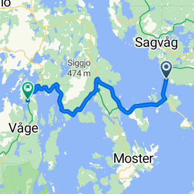
NSCR03
A cycling route starting in Sagvåg, Hordaland, Norway.
Overview
About this route
- -:--
- Duration
- 39.9 km
- Distance
- 392 m
- Ascent
- 412 m
- Descent
- ---
- Avg. speed
- ---
- Max. altitude

Continue with Bikemap
Use, edit, or download this cycling route
You would like to ride NSCR03 or customize it for your own trip? Here is what you can do with this Bikemap route:
Free features
- Save this route as favorite or in collections
- Copy & plan your own version of this route
- Sync your route with Garmin or Wahoo
Premium features
Free trial for 3 days, or one-time payment. More about Bikemap Premium.
- Navigate this route on iOS & Android
- Export a GPX / KML file of this route
- Create your custom printout (try it for free)
- Download this route for offline navigation
Discover more Premium features.
Get Bikemap PremiumFrom our community
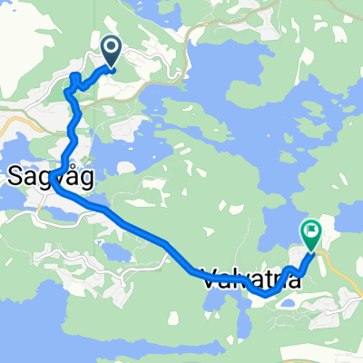
Other popular routes starting in Sagvåg
 Åkervikåsen 26 to Kon-tikivegen 15
- Distance
- 80.9 km
- Ascent
- 1,253 m
- Descent
- 1,272 m
- Location
- Sagvåg, Hordaland, Norway
 Fitjarvegen 214, Sagvåg to Fitjarvegen 389–391, Sagvåg
- Distance
- 3.3 km
- Ascent
- 54 m
- Descent
- 31 m
- Location
- Sagvåg, Hordaland, Norway
 BS J1 PM 2
- Distance
- 18.6 km
- Ascent
- 247 m
- Descent
- 313 m
- Location
- Sagvåg, Hordaland, Norway
 Nysæterstølen 64D to Hiljesgjerdet
- Distance
- 5.6 km
- Ascent
- 107 m
- Descent
- 113 m
- Location
- Sagvåg, Hordaland, Norway
 Sommer 2020 - dag 4
- Distance
- 110.2 km
- Ascent
- 427 m
- Descent
- 426 m
- Location
- Sagvåg, Hordaland, Norway
 Day 86 Part 1
- Distance
- 30.7 km
- Ascent
- 293 m
- Descent
- 314 m
- Location
- Sagvåg, Hordaland, Norway
 Route 1, day 10 Sagvag to Bergen
- Distance
- 84.4 km
- Ascent
- 1,888 m
- Descent
- 1,895 m
- Location
- Sagvåg, Hordaland, Norway
 Åkervikåsen 26 to Brandasundvegen 501
- Distance
- 55.8 km
- Ascent
- 1,007 m
- Descent
- 1,050 m
- Location
- Sagvåg, Hordaland, Norway
Open it in the app