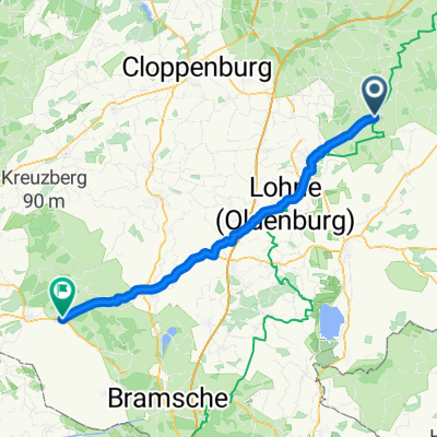
Sommer 2020 Teil1
A cycling route starting in Goldenstedt, Lower Saxony, Germany.
Overview
About this route
- -:--
- Duration
- 500.7 km
- Distance
- 449 m
- Ascent
- 431 m
- Descent
- ---
- Avg. speed
- ---
- Avg. speed
Route quality
Waytypes & surfaces along the route
Waytypes
Path
146.3 km
(29 %)
Quiet road
117.1 km
(23 %)
Surfaces
Paved
391.5 km
(78 %)
Unpaved
11.6 km
(2 %)
Asphalt
328.7 km
(66 %)
Paving stones
29.8 km
(6 %)
Route highlights
Points of interest along the route
Accommodation after 335.1 km
Continue with Bikemap
Use, edit, or download this cycling route
You would like to ride Sommer 2020 Teil1 or customize it for your own trip? Here is what you can do with this Bikemap route:
Free features
- Save this route as favorite or in collections
- Copy & plan your own version of this route
- Sync your route with Garmin or Wahoo
Premium features
Free trial for 3 days, or one-time payment. More about Bikemap Premium.
- Navigate this route on iOS & Android
- Export a GPX / KML file of this route
- Create your custom printout (try it for free)
- Download this route for offline navigation
Discover more Premium features.
Get Bikemap PremiumFrom our community
Other popular routes starting in Goldenstedt
- Von Goldenstedt nach Brokum (über Vecta)
- Distance
- 59.4 km
- Ascent
- 176 m
- Descent
- 157 m
- Location
- Goldenstedt, Lower Saxony, Germany
- Goldenstedt Colnrade
- Distance
- 13.9 km
- Ascent
- 45 m
- Descent
- 43 m
- Location
- Goldenstedt, Lower Saxony, Germany
- Zur Talsperre
- Distance
- 100.7 km
- Ascent
- 370 m
- Descent
- 368 m
- Location
- Goldenstedt, Lower Saxony, Germany
- Moorroute
- Distance
- 33.5 km
- Ascent
- 42 m
- Descent
- 41 m
- Location
- Goldenstedt, Lower Saxony, Germany
- MTB zum Tonnenmoor
- Distance
- 52 km
- Ascent
- 214 m
- Descent
- 216 m
- Location
- Goldenstedt, Lower Saxony, Germany
- Zur Engelmanns Bäke 50 km
- Distance
- 49.9 km
- Ascent
- 69 m
- Descent
- 67 m
- Location
- Goldenstedt, Lower Saxony, Germany
- Rennrad-Tour zum Steinfelder Moor
- Distance
- 80.6 km
- Ascent
- 178 m
- Descent
- 180 m
- Location
- Goldenstedt, Lower Saxony, Germany
- Huntetalroute
- Distance
- 36.5 km
- Ascent
- 72 m
- Descent
- 70 m
- Location
- Goldenstedt, Lower Saxony, Germany
Open it in the app