Forchheim - Muggendorf - hängender Stein
A cycling route starting in Wiesenthau, Bavaria, Germany.
Overview
About this route
Approximate travel time 4h / only MTB / route planning with Kompass hiking map 1:50,000 No. 170 !!
- -:--
- Duration
- 43.1 km
- Distance
- 707 m
- Ascent
- 684 m
- Descent
- ---
- Avg. speed
- 549 m
- Max. altitude
Route quality
Waytypes & surfaces along the route
Waytypes
Track
25.4 km
(59 %)
Quiet road
8.6 km
(20 %)
Surfaces
Paved
13.8 km
(32 %)
Unpaved
21.6 km
(50 %)
Gravel
14.2 km
(33 %)
Asphalt
12.5 km
(29 %)
Continue with Bikemap
Use, edit, or download this cycling route
You would like to ride Forchheim - Muggendorf - hängender Stein or customize it for your own trip? Here is what you can do with this Bikemap route:
Free features
- Save this route as favorite or in collections
- Copy & plan your own version of this route
- Sync your route with Garmin or Wahoo
Premium features
Free trial for 3 days, or one-time payment. More about Bikemap Premium.
- Navigate this route on iOS & Android
- Export a GPX / KML file of this route
- Create your custom printout (try it for free)
- Download this route for offline navigation
Discover more Premium features.
Get Bikemap PremiumFrom our community
Other popular routes starting in Wiesenthau
- Mühlenhof - Pretzfeld - Ebermannstadt - Mühlenhof
- Distance
- 19.5 km
- Ascent
- 65 m
- Descent
- 59 m
- Location
- Wiesenthau, Bavaria, Germany
- Rundtour Wiesenthau - Glückstadt - Hirschaid
- Distance
- 61.1 km
- Ascent
- 334 m
- Descent
- 325 m
- Location
- Wiesenthau, Bavaria, Germany
- Forchheim - Muggendorf - hängender Stein
- Distance
- 43.1 km
- Ascent
- 707 m
- Descent
- 684 m
- Location
- Wiesenthau, Bavaria, Germany
- Feierabendrunde
- Distance
- 41.2 km
- Ascent
- 354 m
- Descent
- 336 m
- Location
- Wiesenthau, Bavaria, Germany
- Durch die Bärenschlucht
- Distance
- 94.3 km
- Ascent
- 795 m
- Descent
- 793 m
- Location
- Wiesenthau, Bavaria, Germany
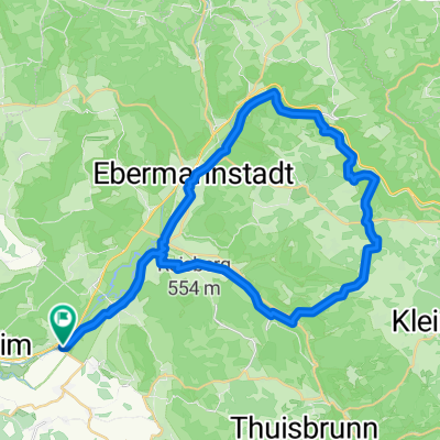
- Fränkische Schweiz ab Forchheim - Reuth
- Distance
- 51.2 km
- Ascent
- 731 m
- Descent
- 613 m
- Location
- Wiesenthau, Bavaria, Germany
- FaC Rund ums Waberla
- Distance
- 9.5 km
- Ascent
- 107 m
- Descent
- 44 m
- Location
- Wiesenthau, Bavaria, Germany
- After Work Sonnenuntergangstour
- Distance
- 9.5 km
- Ascent
- 284 m
- Descent
- 273 m
- Location
- Wiesenthau, Bavaria, Germany
Open it in the app