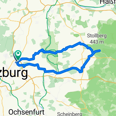
Estenfeld - Fladungen / Rhön
A cycling route starting in Estenfeld, Bavaria, Germany.
Overview
About this route
- -:--
- Duration
- 102.3 km
- Distance
- 503 m
- Ascent
- 312 m
- Descent
- ---
- Avg. speed
- ---
- Max. altitude
Route quality
Waytypes & surfaces along the route
Waytypes
Road
26.4 km
(26 %)
Quiet road
24.5 km
(24 %)
Surfaces
Paved
85.7 km
(84 %)
Unpaved
8 km
(8 %)
Asphalt
79.7 km
(78 %)
Paved (undefined)
4.1 km
(4 %)
Continue with Bikemap
Use, edit, or download this cycling route
You would like to ride Estenfeld - Fladungen / Rhön or customize it for your own trip? Here is what you can do with this Bikemap route:
Free features
- Save this route as favorite or in collections
- Copy & plan your own version of this route
- Split it into stages to create a multi-day tour
- Sync your route with Garmin or Wahoo
Premium features
Free trial for 3 days, or one-time payment. More about Bikemap Premium.
- Navigate this route on iOS & Android
- Export a GPX / KML file of this route
- Create your custom printout (try it for free)
- Download this route for offline navigation
Discover more Premium features.
Get Bikemap PremiumFrom our community
Other popular routes starting in Estenfeld
- Schnelle Radrunde von Mühlhausen nach Würzburg
- Distance
- 6.5 km
- Ascent
- 15 m
- Descent
- 94 m
- Location
- Estenfeld, Bavaria, Germany
- Fladungen
- Distance
- 92.3 km
- Ascent
- 584 m
- Descent
- 408 m
- Location
- Estenfeld, Bavaria, Germany
- Lengfeld- Mainschleifentour- Lengfeld
- Distance
- 43.4 km
- Ascent
- 138 m
- Descent
- 124 m
- Location
- Estenfeld, Bavaria, Germany
- Main Traum
- Distance
- 87.8 km
- Ascent
- 302 m
- Descent
- 302 m
- Location
- Estenfeld, Bavaria, Germany
- Estenfeld - Fladungen / Rhön
- Distance
- 102.3 km
- Ascent
- 503 m
- Descent
- 312 m
- Location
- Estenfeld, Bavaria, Germany
- Estenfeld - Schweinfurt
- Distance
- 32.6 km
- Ascent
- 134 m
- Descent
- 184 m
- Location
- Estenfeld, Bavaria, Germany
- 20170316_175511.gpx
- Distance
- 12.7 km
- Ascent
- 170 m
- Descent
- 164 m
- Location
- Estenfeld, Bavaria, Germany
- Estenfeld-Dettelbach-KT-Wü
- Distance
- 43.2 km
- Ascent
- 307 m
- Descent
- 294 m
- Location
- Estenfeld, Bavaria, Germany
Open it in the app