

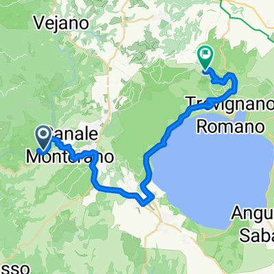
Ponton di sotto
A cycling route starting in Canale Monterano, Lazio, Italy.
Overview
About this route
- 1 h 40 min
- Duration
- 9.9 km
- Distance
- 138 m
- Ascent
- 142 m
- Descent
- 6 km/h
- Avg. speed
- ---
- Max. altitude

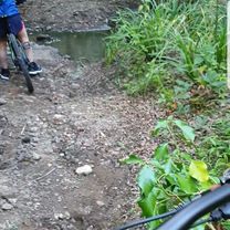
Route photos


Continue with Bikemap
Use, edit, or download this cycling route
You would like to ride Ponton di sotto or customize it for your own trip? Here is what you can do with this Bikemap route:
Free features
- Save this route as favorite or in collections
- Copy & plan your own version of this route
- Sync your route with Garmin or Wahoo
Premium features
Free trial for 3 days, or one-time payment. More about Bikemap Premium.
- Navigate this route on iOS & Android
- Export a GPX / KML file of this route
- Create your custom printout (try it for free)
- Download this route for offline navigation
Discover more Premium features.
Get Bikemap PremiumFrom our community
Other popular routes starting in Canale Monterano
 Long ride from Canale Monterano to Sutri
- Distance
- 33.1 km
- Ascent
- 605 m
- Descent
- 433 m
- Location
- Canale Monterano, Lazio, Italy
 Camminata Cascate Diosilla - Monterano antica
- Distance
- 3.3 km
- Ascent
- 134 m
- Descent
- 135 m
- Location
- Canale Monterano, Lazio, Italy
 manziana run
- Distance
- 7.8 km
- Ascent
- 131 m
- Descent
- 130 m
- Location
- Canale Monterano, Lazio, Italy
 NEW M2R Day 12 Bagni di Terme to Rome - NEW M2R Day 12 Bagni di Terme to Rome
- Distance
- 75.3 km
- Ascent
- 819 m
- Descent
- 1,050 m
- Location
- Canale Monterano, Lazio, Italy
 Monterano-Barbarano
- Distance
- 20.3 km
- Ascent
- 583 m
- Descent
- 546 m
- Location
- Canale Monterano, Lazio, Italy
 Anello Canale Monterano
- Distance
- 53.4 km
- Ascent
- 618 m
- Descent
- 617 m
- Location
- Canale Monterano, Lazio, Italy
 matest2
- Distance
- 21.6 km
- Ascent
- 624 m
- Descent
- 626 m
- Location
- Canale Monterano, Lazio, Italy
 Ponton di sotto
- Distance
- 9.9 km
- Ascent
- 138 m
- Descent
- 142 m
- Location
- Canale Monterano, Lazio, Italy
Open it in the app