
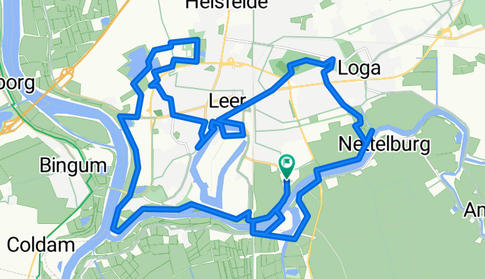
Stadtökologischer LEER-Pfad 3.0
A cycling route starting in Leer, Lower Saxony, Germany.
Overview
About this route
multi Süd, Osseweg 87, Leer (Ostfriesland)
- -:--
- Duration
- 27.4 km
- Distance
- 16 m
- Ascent
- 14 m
- Descent
- ---
- Avg. speed
- ---
- Max. altitude
Continue with Bikemap
Use, edit, or download this cycling route
You would like to ride Stadtökologischer LEER-Pfad 3.0 or customize it for your own trip? Here is what you can do with this Bikemap route:
Free features
- Save this route as favorite or in collections
- Copy & plan your own version of this route
- Sync your route with Garmin or Wahoo
Premium features
Free trial for 3 days, or one-time payment. More about Bikemap Premium.
- Navigate this route on iOS & Android
- Export a GPX / KML file of this route
- Create your custom printout (try it for free)
- Download this route for offline navigation
Discover more Premium features.
Get Bikemap PremiumFrom our community
Other popular routes starting in Leer
 Von Leer nach Emden und zurück
- Distance
- 63.6 km
- Ascent
- 9 m
- Descent
- 9 m
- Location
- Leer, Lower Saxony, Germany
 Leda-Jümme-Runde
- Distance
- 42.9 km
- Ascent
- 14 m
- Descent
- 21 m
- Location
- Leer, Lower Saxony, Germany
 Leer Holtland Leer
- Distance
- 56.1 km
- Ascent
- 24 m
- Descent
- 23 m
- Location
- Leer, Lower Saxony, Germany
 Große MMLD-Runde
- Distance
- 23.3 km
- Ascent
- 0 m
- Descent
- 0 m
- Location
- Leer, Lower Saxony, Germany
 Niederlande Nord-Ost
- Distance
- 748.9 km
- Ascent
- 101 m
- Descent
- 99 m
- Location
- Leer, Lower Saxony, Germany
 Radrunde durch Leer
- Distance
- 21.6 km
- Ascent
- 26 m
- Descent
- 25 m
- Location
- Leer, Lower Saxony, Germany
 Niederlande
- Distance
- 957.2 km
- Ascent
- 437 m
- Descent
- 439 m
- Location
- Leer, Lower Saxony, Germany
 Rheiderland Rundfahrt
- Distance
- 63.4 km
- Ascent
- 32 m
- Descent
- 32 m
- Location
- Leer, Lower Saxony, Germany
Open it in the app