Ruta Los tres Castillos
A cycling route starting in Cimanes del Tejar, Castille and Le贸n, Spain.
Overview
About this route
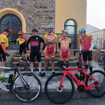
Route organized by the Town Hall of Cimanes del Tejar on the occasion of its Patronal Festivals. It includes the ascent to La Garandilla, not without difficulty.
- -:--
- Duration
- 75.8 km
- Distance
- 317 m
- Ascent
- 317 m
- Descent
- ---
- Avg. speed
- ---
- Max. altitude
Route quality
Waytypes & surfaces along the route
Waytypes
Road
29.6 km
(39 %)
Track
10.6 km
(14 %)
Surfaces
Paved
56.9 km
(75 %)
Asphalt
56.9 km
(75 %)
Undefined
19 km
(25 %)
Continue with Bikemap
Use, edit, or download this cycling route
You would like to ride Ruta Los tres Castillos or customize it for your own trip? Here is what you can do with this Bikemap route:
Free features
- Save this route as favorite or in collections
- Copy & plan your own version of this route
- Sync your route with Garmin or Wahoo
Premium features
Free trial for 3 days, or one-time payment. More about Bikemap Premium.
- Navigate this route on iOS & Android
- Export a GPX / KML file of this route
- Create your custom printout (try it for free)
- Download this route for offline navigation
Discover more Premium features.
Get Bikemap PremiumFrom our community
Other popular routes starting in Cimanes del Tejar
- Ruta a Calle Carretera, 9, Carrizo
- Distance
- 20.2 km
- Ascent
- 207 m
- Descent
- 310 m
- Location
- Cimanes del Tejar, Castille and Le贸n, Spain
- aralla
- Distance
- 114.7 km
- Ascent
- 1,023 m
- Descent
- 1,021 m
- Location
- Cimanes del Tejar, Castille and Le贸n, Spain
- De Avenida Le贸n a Calle V1 171A, Valverde de la Virgen
- Distance
- 31.6 km
- Ascent
- 228 m
- Descent
- 191 m
- Location
- Cimanes del Tejar, Castille and Le贸n, Spain
- Ruta Los tres Castillos
- Distance
- 75.8 km
- Ascent
- 317 m
- Descent
- 317 m
- Location
- Cimanes del Tejar, Castille and Le贸n, Spain
- De Calle de San Andr茅s, 49, Cimanes del Tejar a Avenida de San Roque, 16, Rioseco de Tapia
- Distance
- 8.8 km
- Ascent
- 51 m
- Descent
- 26 m
- Location
- Cimanes del Tejar, Castille and Le贸n, Spain
- 64km ruta de cimanes del Tejar
- Distance
- 64.5 km
- Ascent
- 464 m
- Descent
- 531 m
- Location
- Cimanes del Tejar, Castille and Le贸n, Spain
- cimanes la magdalena aralla IDA
- Distance
- 52.9 km
- Ascent
- 1,022 m
- Descent
- 367 m
- Location
- Cimanes del Tejar, Castille and Le贸n, Spain
Open it in the app