

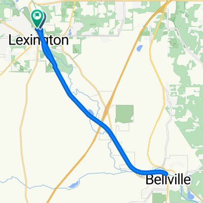
Sporty route in Mansfield
A cycling route starting in Lexington, Ohio, United States.
Overview
About this route
- 14 min
- Duration
- 5.4 km
- Distance
- 42 m
- Ascent
- 25 m
- Descent
- 22.3 km/h
- Avg. speed
- ---
- Max. altitude
Route quality
Waytypes & surfaces along the route
Waytypes
Quiet road
2 km
(37 %)
Road
0.5 km
(10 %)
Surfaces
Unpaved
1.4 km
(26 %)
Unpaved (undefined)
1.4 km
(26 %)
Undefined
4 km
(74 %)
Continue with Bikemap
Use, edit, or download this cycling route
You would like to ride Sporty route in Mansfield or customize it for your own trip? Here is what you can do with this Bikemap route:
Free features
- Save this route as favorite or in collections
- Copy & plan your own version of this route
- Sync your route with Garmin or Wahoo
Premium features
Free trial for 3 days, or one-time payment. More about Bikemap Premium.
- Navigate this route on iOS & Android
- Export a GPX / KML file of this route
- Create your custom printout (try it for free)
- Download this route for offline navigation
Discover more Premium features.
Get Bikemap PremiumFrom our community
Other popular routes starting in Lexington
 South Mill Street 55, Lexington to South Mill Street 55, Lexington
- Distance
- 11.2 km
- Ascent
- 32 m
- Descent
- 32 m
- Location
- Lexington, Ohio, United States
 144 Plymouth St, Lexington to 144 Plymouth St, Lexington
- Distance
- 12.7 km
- Ascent
- 49 m
- Descent
- 59 m
- Location
- Lexington, Ohio, United States
 7471 SR-97, Mansfield to Richland B and O Trail, Bellville
- Distance
- 18.7 km
- Ascent
- 213 m
- Descent
- 237 m
- Location
- Lexington, Ohio, United States
 144 Plymouth St, Lexington to 144 Plymouth St, Lexington
- Distance
- 12.8 km
- Ascent
- 124 m
- Descent
- 122 m
- Location
- Lexington, Ohio, United States
 Lexington OH to Cape Carteret NC
- Distance
- 1,381.5 km
- Ascent
- 1,207 m
- Descent
- 1,567 m
- Location
- Lexington, Ohio, United States
 Moderate route in Lexington
- Distance
- 19.5 km
- Ascent
- 52 m
- Descent
- 55 m
- Location
- Lexington, Ohio, United States
 Steady ride in Mount Gilead
- Distance
- 8.2 km
- Ascent
- 57 m
- Descent
- 47 m
- Location
- Lexington, Ohio, United States
 lex to johns to blvl to lex
- Distance
- 35 km
- Ascent
- 234 m
- Descent
- 241 m
- Location
- Lexington, Ohio, United States
Open it in the app