

Niederaltteicher Bayerwald-Schaukel
A cycling route starting in Niederalteich, Bavaria, Germany.
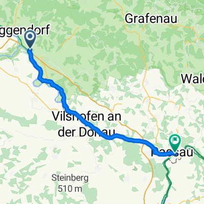
Overview
About this route
Hearty start to the Bavarian Forest with a solid amount of elevation gain
This route, starting from Niederaltteich, combines many great highlights of the Deggendorf hinterland:
-
Monastery and Basilica of Niederaltteich
-
Danube-Ilz Express Cycle Path (from Hengersberg to Schönach)
-
Brotjacklriegel loop (complete summit conquest not recommended on a road bike as it is unpaved!! steep climb up to 15%)
-
Dösing-Ranzing loop (through lush green surroundings)
-
Rusel ascent (1 kilometer at 10%)
-
fast descent on the St2135
-
quiet, sneaky ride back via Eichberg to Niederaltteich
With this rich variety, there should really be something for everyone ;-)
The tour is further enriched by its proud total length, a varied and charming hilly landscape, and many good and mostly quiet side roads.
Rating: highly recommended and challenging!!!
- -:--
- Duration
- 104.3 km
- Distance
- 1,672 m
- Ascent
- 1,674 m
- Descent
- ---
- Avg. speed
- ---
- Max. altitude
Route quality
Waytypes & surfaces along the route
Waytypes
Road
44.9 km
(43 %)
Quiet road
25 km
(24 %)
Surfaces
Paved
89.7 km
(86 %)
Unpaved
3.1 km
(3 %)
Asphalt
87.6 km
(84 %)
Paved (undefined)
2.1 km
(2 %)
Continue with Bikemap
Use, edit, or download this cycling route
You would like to ride Niederaltteicher Bayerwald-Schaukel or customize it for your own trip? Here is what you can do with this Bikemap route:
Free features
- Save this route as favorite or in collections
- Copy & plan your own version of this route
- Split it into stages to create a multi-day tour
- Sync your route with Garmin or Wahoo
Premium features
Free trial for 3 days, or one-time payment. More about Bikemap Premium.
- Navigate this route on iOS & Android
- Export a GPX / KML file of this route
- Create your custom printout (try it for free)
- Download this route for offline navigation
Discover more Premium features.
Get Bikemap PremiumFrom our community
Other popular routes starting in Niederalteich
 Niederaltteicher Bayerwald-Schaukel
- Distance
- 104.3 km
- Ascent
- 1,672 m
- Descent
- 1,674 m
- Location
- Niederalteich, Bavaria, Germany
 von der Donau zur Rusel
- Distance
- 19.1 km
- Ascent
- 527 m
- Descent
- 170 m
- Location
- Niederalteich, Bavaria, Germany
 Niederalteich-Poppenberg-Ohetal-Niederalteich
- Distance
- 51.8 km
- Ascent
- 374 m
- Descent
- 377 m
- Location
- Niederalteich, Bavaria, Germany
 Plattling über Nideralteich
- Distance
- 24.2 km
- Ascent
- 77 m
- Descent
- 71 m
- Location
- Niederalteich, Bavaria, Germany
 Niederalteich-March-Zottling-St.Englmar-Bogen-Deg-Niederalteich
- Distance
- 137.2 km
- Ascent
- 1,499 m
- Descent
- 1,492 m
- Location
- Niederalteich, Bavaria, Germany
 Schwarzacher Straße nach Bräugasse
- Distance
- 52.7 km
- Ascent
- 133 m
- Descent
- 142 m
- Location
- Niederalteich, Bavaria, Germany
 MTB Tour Donautal CLONED FROM ROUTE 1018981
- Distance
- 43.1 km
- Ascent
- 152 m
- Descent
- 152 m
- Location
- Niederalteich, Bavaria, Germany
 MTB Tour Donautal
- Distance
- 43.1 km
- Ascent
- 181 m
- Descent
- 182 m
- Location
- Niederalteich, Bavaria, Germany
Open it in the app