

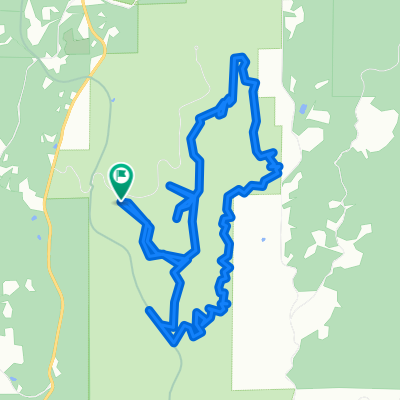
Jefferson Avenue 450, Vernonia to Bridge Street 182-184, Vernonia
A cycling route starting in Vernonia, Oregon, United States.
Overview
About this route
- 1 h 48 min
- Duration
- 28.8 km
- Distance
- 231 m
- Ascent
- 237 m
- Descent
- 15.9 km/h
- Avg. speed
- ---
- Max. altitude

Route photos

Route quality
Waytypes & surfaces along the route
Waytypes
Cycleway
27.4 km
(95 %)
Busy road
1 km
(3 %)
Surfaces
Paved
28.5 km
(99 %)
Asphalt
28 km
(97 %)
Paved (undefined)
0.4 km
(1 %)
Continue with Bikemap
Use, edit, or download this cycling route
You would like to ride Jefferson Avenue 450, Vernonia to Bridge Street 182-184, Vernonia or customize it for your own trip? Here is what you can do with this Bikemap route:
Free features
- Save this route as favorite or in collections
- Copy & plan your own version of this route
- Sync your route with Garmin or Wahoo
Premium features
Free trial for 3 days, or one-time payment. More about Bikemap Premium.
- Navigate this route on iOS & Android
- Export a GPX / KML file of this route
- Create your custom printout (try it for free)
- Download this route for offline navigation
Discover more Premium features.
Get Bikemap PremiumFrom our community
Other popular routes starting in Vernonia
 Vernonia Cycling
- Distance
- 110.2 km
- Ascent
- 601 m
- Descent
- 798 m
- Location
- Vernonia, Oregon, United States
 LL stub loop
- Distance
- 12.3 km
- Ascent
- 869 m
- Descent
- 867 m
- Location
- Vernonia, Oregon, United States
 Camp Wilkerson to Great Vow via Hwy 47
- Distance
- 49.5 km
- Ascent
- 327 m
- Descent
- 689 m
- Location
- Vernonia, Oregon, United States
 Vernonia Loop
- Distance
- 81.4 km
- Ascent
- 734 m
- Descent
- 734 m
- Location
- Vernonia, Oregon, United States
 Veronia Banks
- Distance
- 11 km
- Ascent
- 248 m
- Descent
- 216 m
- Location
- Vernonia, Oregon, United States
 June 26
- Distance
- 35 km
- Ascent
- 472 m
- Descent
- 603 m
- Location
- Vernonia, Oregon, United States
 Jefferson Avenue 450, Vernonia to Bridge Street 182-184, Vernonia
- Distance
- 28.8 km
- Ascent
- 231 m
- Descent
- 237 m
- Location
- Vernonia, Oregon, United States
 Lengthy Afternoon Course In Buxton
- Distance
- 17.1 km
- Ascent
- 182 m
- Descent
- 462 m
- Location
- Vernonia, Oregon, United States
Open it in the app