

Fahrrad FFG-Leibnitz
A cycling route starting in Feldkirchen bei Graz, Styria, Austria.
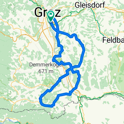
Overview
About this route
11.6.2020: MccS
Start: 10:30, Ankunft 15:00 (Lange Pause in Werndorf, kleinere Pausen zwischendurch - gesamt ca. 1h Pause)
- -:--
- Duration
- 37.8 km
- Distance
- 19 m
- Ascent
- 94 m
- Descent
- ---
- Avg. speed
- ---
- Max. altitude
Route quality
Waytypes & surfaces along the route
Waytypes
Quiet road
13.8 km
(36 %)
Track
7.2 km
(19 %)
Surfaces
Paved
23.9 km
(63 %)
Unpaved
5.7 km
(15 %)
Asphalt
22.8 km
(60 %)
Gravel
4 km
(10 %)
Continue with Bikemap
Use, edit, or download this cycling route
You would like to ride Fahrrad FFG-Leibnitz or customize it for your own trip? Here is what you can do with this Bikemap route:
Free features
- Save this route as favorite or in collections
- Copy & plan your own version of this route
- Sync your route with Garmin or Wahoo
Premium features
Free trial for 3 days, or one-time payment. More about Bikemap Premium.
- Navigate this route on iOS & Android
- Export a GPX / KML file of this route
- Create your custom printout (try it for free)
- Download this route for offline navigation
Discover more Premium features.
Get Bikemap PremiumFrom our community
Other popular routes starting in Feldkirchen bei Graz
 Flughafenrunde
- Distance
- 36 km
- Ascent
- 118 m
- Descent
- 116 m
- Location
- Feldkirchen bei Graz, Styria, Austria
 graz-weiz-sommeralm-teichalm-recgberg
- Distance
- 125.8 km
- Ascent
- 2,423 m
- Descent
- 2,406 m
- Location
- Feldkirchen bei Graz, Styria, Austria
 Florianiberg - Plabutsch Runde
- Distance
- 40 km
- Ascent
- 624 m
- Descent
- 624 m
- Location
- Feldkirchen bei Graz, Styria, Austria
 graz-preding-wildon
- Distance
- 63.6 km
- Ascent
- 343 m
- Descent
- 360 m
- Location
- Feldkirchen bei Graz, Styria, Austria
 graz-pack-weinebene
- Distance
- 174.1 km
- Ascent
- 3,579 m
- Descent
- 3,589 m
- Location
- Feldkirchen bei Graz, Styria, Austria
 Graz - Süd-West Steiermark
- Distance
- 146.9 km
- Ascent
- 1,020 m
- Descent
- 988 m
- Location
- Feldkirchen bei Graz, Styria, Austria
 Sattlerstraße nach Mühlgangweg
- Distance
- 7.9 km
- Ascent
- 8 m
- Descent
- 20 m
- Location
- Feldkirchen bei Graz, Styria, Austria
 graz-st.nikolai i.s.
- Distance
- 78.8 km
- Ascent
- 283 m
- Descent
- 283 m
- Location
- Feldkirchen bei Graz, Styria, Austria
Open it in the app