

Beromünster Sendeturm (Tour B)
A cycling route starting in Oberlunkhofen, Canton of Aargau, Switzerland.
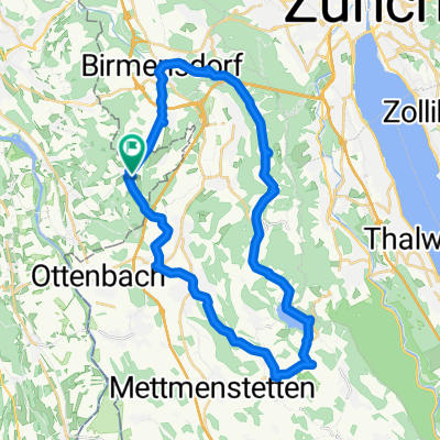
Overview
About this route
- -:--
- Duration
- 106.4 km
- Distance
- 1,264 m
- Ascent
- 1,265 m
- Descent
- ---
- Avg. speed
- ---
- Max. altitude
Route quality
Waytypes & surfaces along the route
Waytypes
Road
37.2 km
(35 %)
Quiet road
30.8 km
(29 %)
Surfaces
Paved
43.6 km
(41 %)
Asphalt
40.4 km
(38 %)
Paved (undefined)
3.2 km
(3 %)
Undefined
62.7 km
(59 %)
Route highlights
Points of interest along the route
Point of interest after 41.2 km
Sendeturm Beromünster
Drinking water after 60.5 km
Drinking water after 72.1 km
Drinking water after 87.5 km
Continue with Bikemap
Use, edit, or download this cycling route
You would like to ride Beromünster Sendeturm (Tour B) or customize it for your own trip? Here is what you can do with this Bikemap route:
Free features
- Save this route as favorite or in collections
- Copy & plan your own version of this route
- Split it into stages to create a multi-day tour
- Sync your route with Garmin or Wahoo
Premium features
Free trial for 3 days, or one-time payment. More about Bikemap Premium.
- Navigate this route on iOS & Android
- Export a GPX / KML file of this route
- Create your custom printout (try it for free)
- Download this route for offline navigation
Discover more Premium features.
Get Bikemap PremiumFrom our community
Other popular routes starting in Oberlunkhofen
 Türlersee
- Distance
- 37.2 km
- Ascent
- 454 m
- Descent
- 439 m
- Location
- Oberlunkhofen, Canton of Aargau, Switzerland
 Beromünster Sendeturm (Tour B)
- Distance
- 106.4 km
- Ascent
- 1,264 m
- Descent
- 1,265 m
- Location
- Oberlunkhofen, Canton of Aargau, Switzerland
 Türlersee Runde
- Distance
- 36.5 km
- Ascent
- 342 m
- Descent
- 341 m
- Location
- Oberlunkhofen, Canton of Aargau, Switzerland
 Beromünster Sendeturm (Tour A)
- Distance
- 111.4 km
- Ascent
- 1,457 m
- Descent
- 1,457 m
- Location
- Oberlunkhofen, Canton of Aargau, Switzerland
 Reuss entlang
- Distance
- 18.4 km
- Ascent
- 101 m
- Descent
- 103 m
- Location
- Oberlunkhofen, Canton of Aargau, Switzerland
 Arni Sins Rundfahrt
- Distance
- 54.4 km
- Ascent
- 429 m
- Descent
- 429 m
- Location
- Oberlunkhofen, Canton of Aargau, Switzerland
 Argovia: Höhen und Flüsse
- Distance
- 132.1 km
- Ascent
- 1,140 m
- Descent
- 1,140 m
- Location
- Oberlunkhofen, Canton of Aargau, Switzerland
 OL-Meisterschwanden-Sins
- Distance
- 85.6 km
- Ascent
- 812 m
- Descent
- 811 m
- Location
- Oberlunkhofen, Canton of Aargau, Switzerland
Open it in the app