

tour 210525 von dipps zum kahleberg
A cycling route starting in Dippoldiswalde, Saxony, Germany.
Overview
About this route
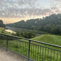
Start at Gerberplatz in Dipps and via Polypark and Kalkofenweg towards Reichstädt. Briefly into the village and right back up to Firstenweg and continue south to Reichstädt. Passing the windmill and chapel (Kahle Höhe) down to Hennersdorf and then to Ammelsdorf. Passing the rock formation Harter Stein (719 hm), Schönfeld and Oberpöbel into the Pöbeltal. Following the path to the Wüsten Teich with great resting opportunities. A short final ascent and detour to Kahleberg (905 hm). Over the 8000er Pöbelknochen (833 hm) passing Schellerhau to the 8000er Stephanshöhe (804 hm). Passing Bärenfels and crossing Hofehübel (692 hm) traversing the Pöbeltal, briefly along the Saubach back up to the Mittelweg towards Naundorf. Past Schlosspark and Ottos Ecke, crossing B 171 up to the Wildgehege. A short passage through Obercarsdorf into Schwarzbachtal and back to Dippoldiswalde.
- -:--
- Duration
- 57.1 km
- Distance
- 915 m
- Ascent
- 915 m
- Descent
- ---
- Avg. speed
- ---
- Max. altitude

Route quality
Waytypes & surfaces along the route
Waytypes
Track
38.3 km
(67 %)
Quiet road
6.9 km
(12 %)
Surfaces
Paved
18.8 km
(33 %)
Unpaved
32 km
(56 %)
Asphalt
16.6 km
(29 %)
Ground
13.7 km
(24 %)
Continue with Bikemap
Use, edit, or download this cycling route
You would like to ride tour 210525 von dipps zum kahleberg or customize it for your own trip? Here is what you can do with this Bikemap route:
Free features
- Save this route as favorite or in collections
- Copy & plan your own version of this route
- Sync your route with Garmin or Wahoo
Premium features
Free trial for 3 days, or one-time payment. More about Bikemap Premium.
- Navigate this route on iOS & Android
- Export a GPX / KML file of this route
- Create your custom printout (try it for free)
- Download this route for offline navigation
Discover more Premium features.
Get Bikemap PremiumFrom our community
Other popular routes starting in Dippoldiswalde
 tour 210525 von dipps zum kahleberg
- Distance
- 57.1 km
- Ascent
- 915 m
- Descent
- 915 m
- Location
- Dippoldiswalde, Saxony, Germany
 DW-FG-202508
- Distance
- 26.5 km
- Ascent
- 588 m
- Descent
- 526 m
- Location
- Dippoldiswalde, Saxony, Germany
 Talsperre Malter - Dresden Hbf
- Distance
- 20.8 km
- Ascent
- 139 m
- Descent
- 361 m
- Location
- Dippoldiswalde, Saxony, Germany
 DW-Rpdf-Berw-Rei-DW
- Distance
- 25.5 km
- Ascent
- 395 m
- Descent
- 396 m
- Location
- Dippoldiswalde, Saxony, Germany
 Dipps - Pirna
- Distance
- 24.7 km
- Ascent
- 301 m
- Descent
- 554 m
- Location
- Dippoldiswalde, Saxony, Germany
 Sachsenman Adventure
- Distance
- 90 km
- Ascent
- 1,111 m
- Descent
- 980 m
- Location
- Dippoldiswalde, Saxony, Germany
 DW-FG-2507
- Distance
- 27 km
- Ascent
- 643 m
- Descent
- 577 m
- Location
- Dippoldiswalde, Saxony, Germany
 Weißerritz 1
- Distance
- 12.6 km
- Ascent
- 211 m
- Descent
- 364 m
- Location
- Dippoldiswalde, Saxony, Germany
Open it in the app