
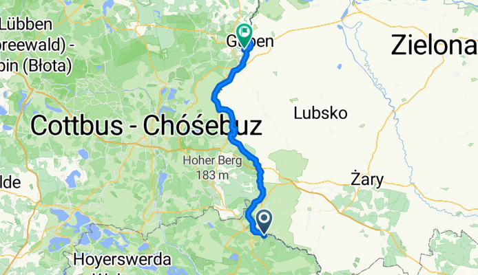
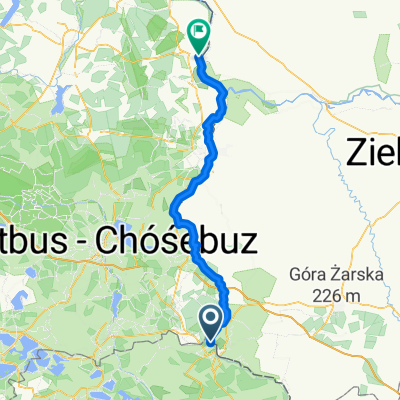
10.07.26 Sagar-Guben (13. Etappe)
A cycling route starting in Łęknica, Lubusz Voivodship, Poland.
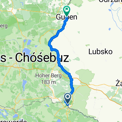
Overview
About this route
From
https://www.bikemap.net/de/route/644741-100725-neschwitz-sagar-12-etappe/
Beautiful route.
Connection
https://www.bikemap.net/de/route/644940-100727-guben-bei-frankfurtoder-14-etappe/
- -:--
- Duration
- 77.1 km
- Distance
- 64 m
- Ascent
- 138 m
- Descent
- ---
- Avg. speed
- ---
- Max. altitude

Route quality
Waytypes & surfaces along the route
Waytypes
Path
25.4 km
(33 %)
Track
23.9 km
(31 %)
Surfaces
Paved
57 km
(74 %)
Unpaved
7.7 km
(10 %)
Asphalt
50.1 km
(65 %)
Concrete
5.4 km
(7 %)
Route highlights
Points of interest along the route
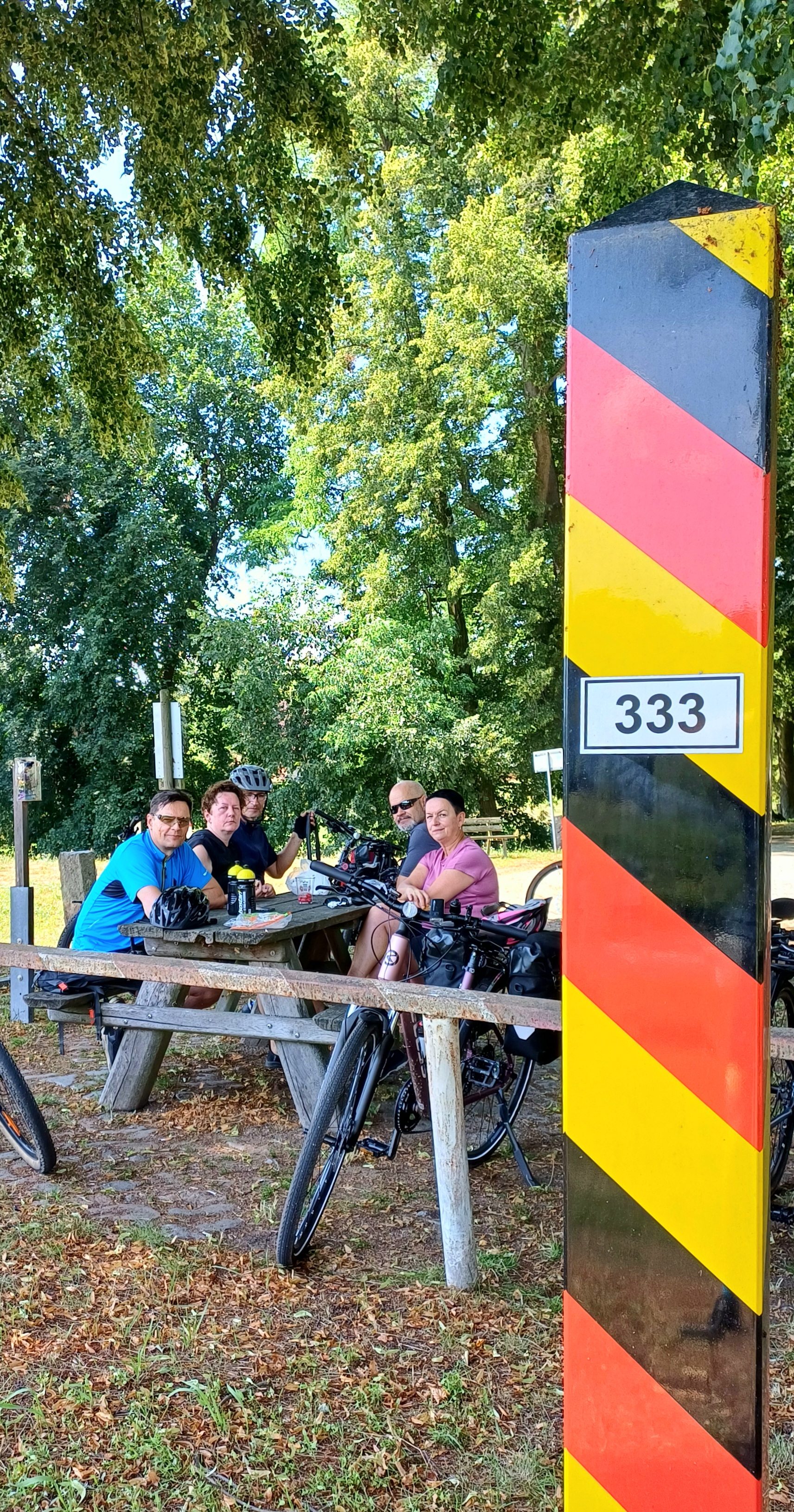
Accommodation after 0 km
Nette, kleine Privatpension mit Bewirtung.
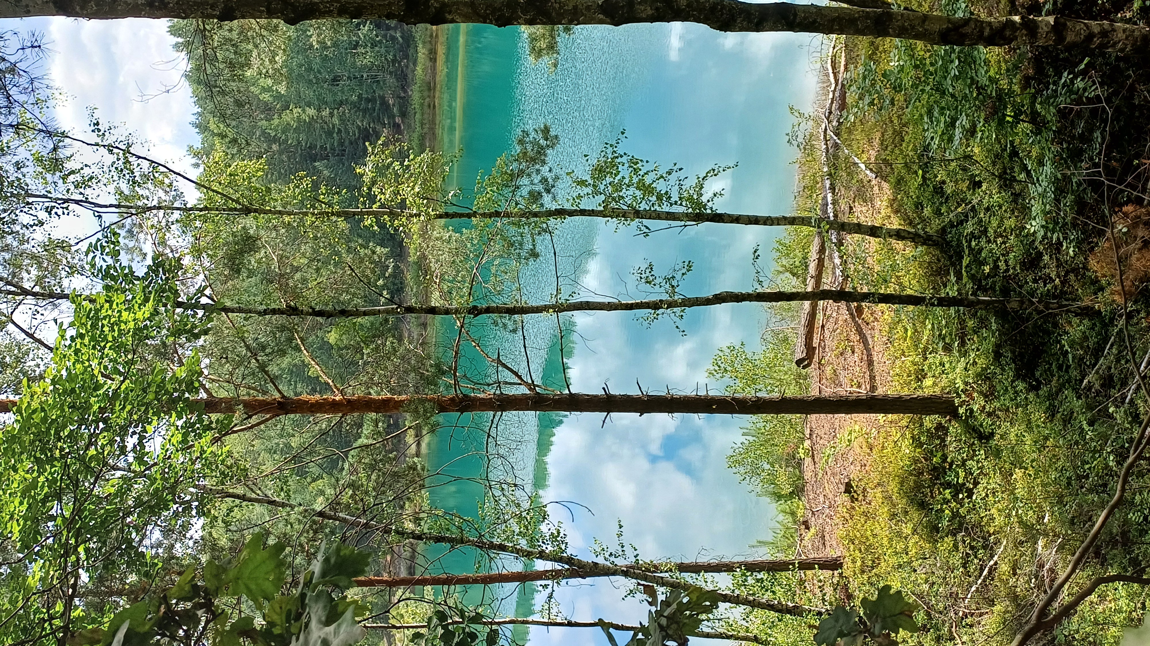
Point of interest after 14.5 km
Ziegenmeierei mit gutem Ziegenkäse.
Point of interest after 64.2 km
Brotzeitpause
Point of interest after 72.2 km
Plastinarium "Körperwelten", G. von Hagens
Point of interest after 76.6 km
"Athen" angenehmes griech. Lokal. Otto-Nuschke-Straße 26, 03172 Guben
Accommodation after 77 km
Sauberes Übernachtungsquartier
Continue with Bikemap
Use, edit, or download this cycling route
You would like to ride 10.07.26 Sagar-Guben (13. Etappe) or customize it for your own trip? Here is what you can do with this Bikemap route:
Free features
- Save this route as favorite or in collections
- Copy & plan your own version of this route
- Sync your route with Garmin or Wahoo
Premium features
Free trial for 3 days, or one-time payment. More about Bikemap Premium.
- Navigate this route on iOS & Android
- Export a GPX / KML file of this route
- Create your custom printout (try it for free)
- Download this route for offline navigation
Discover more Premium features.
Get Bikemap PremiumFrom our community
Other popular routes starting in Łęknica
 D 03 90km Muskau-Eisenh.
- Distance
- 90.3 km
- Ascent
- 334 m
- Descent
- 421 m
- Location
- Łęknica, Lubusz Voivodship, Poland
 10.07.26-10.08.03"A nette Tour"
- Distance
- 566.8 km
- Ascent
- 212 m
- Descent
- 328 m
- Location
- Łęknica, Lubusz Voivodship, Poland
 Park Mużakowski - Forst
- Distance
- 37.3 km
- Ascent
- 185 m
- Descent
- 252 m
- Location
- Łęknica, Lubusz Voivodship, Poland
 Route in Bad Muskau
- Distance
- 20.9 km
- Ascent
- 220 m
- Descent
- 220 m
- Location
- Łęknica, Lubusz Voivodship, Poland
 Aussichtsreiche Radrunde im sorbischen Siedlungsgebiet
- Distance
- 20.1 km
- Ascent
- 176 m
- Descent
- 176 m
- Location
- Łęknica, Lubusz Voivodship, Poland
 Park Mużakowski rowerem
- Distance
- 35.4 km
- Ascent
- 674 m
- Descent
- 687 m
- Location
- Łęknica, Lubusz Voivodship, Poland
 002_Mitteldeutschlandtour2010_Tag02_Bad Muskau-Burg(Spreewald)
- Distance
- 66.2 km
- Ascent
- 91 m
- Descent
- 154 m
- Location
- Łęknica, Lubusz Voivodship, Poland
 Brody - Eisenhüttenstadt
- Distance
- 64.4 km
- Ascent
- 285 m
- Descent
- 356 m
- Location
- Łęknica, Lubusz Voivodship, Poland
Open it in the app