

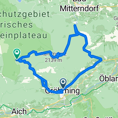
Stoderzinken - Viehbergalm - Salzastausee
A cycling route starting in Gröbming, Styria, Austria.
Overview
About this route
Wunderschöne Tour! Stoderzinken Asphaltstraße. Viehbergalm Schotter
- -:--
- Duration
- 53.9 km
- Distance
- 1,884 m
- Ascent
- 1,784 m
- Descent
- ---
- Avg. speed
- ---
- Max. altitude

Route quality
Waytypes & surfaces along the route
Waytypes
Track
22.6 km
(42 %)
Road
20.5 km
(38 %)
Surfaces
Paved
26.4 km
(49 %)
Unpaved
22.6 km
(42 %)
Asphalt
26.4 km
(49 %)
Gravel
22.6 km
(42 %)
Undefined
4.9 km
(9 %)
Route highlights
Points of interest along the route

Point of interest after 1 km
Asphaltstraße nach Öblarn, wenig Verkehr. Blick zumStoderzinken retour :-)

Point of interest after 7.6 km
Alte Mautstelle Jausenstation. Sehr nette Bewirtschaftung,Rucksackabnahme für Stoderfahrt, danke!

Point of interest after 15.6 km
9km 12%Steigung ab alter Mautstelle

Point of interest after 17.4 km
Am Stoderzinken

Point of interest after 33.6 km
Öfen! Nicht abschrecken lassen :-) Selbst wenn man das Rad tragen müsste, wäre es dieses Stück Natur wert!! Wunderschöne Tour.

Point of interest after 42.6 km
Viehbergalm, drei bewirtschaftete Hütten

Point of interest after 47 km
Salzastausee, wunderschönes Stück. Tipp: Am besten oben stehen bleiben um die Aussicht genießen zu können. Schafberg etc. Wahnsinns Aussichten

Point of interest after 53.9 km
Einfach nur schön die gesamte Tour. Alle Mühen war sie wert!
Continue with Bikemap
Use, edit, or download this cycling route
You would like to ride Stoderzinken - Viehbergalm - Salzastausee or customize it for your own trip? Here is what you can do with this Bikemap route:
Free features
- Save this route as favorite or in collections
- Copy & plan your own version of this route
- Sync your route with Garmin or Wahoo
Premium features
Free trial for 3 days, or one-time payment. More about Bikemap Premium.
- Navigate this route on iOS & Android
- Export a GPX / KML file of this route
- Create your custom printout (try it for free)
- Download this route for offline navigation
Discover more Premium features.
Get Bikemap PremiumFrom our community
Other popular routes starting in Gröbming
 Dachsteinrunde 2
- Distance
- 76 km
- Ascent
- 2,262 m
- Descent
- 1,880 m
- Location
- Gröbming, Styria, Austria
 Viehbergrunde
- Distance
- 50.6 km
- Ascent
- 1,556 m
- Descent
- 936 m
- Location
- Gröbming, Styria, Austria
 Bachweg 1006, Gröbming nach Wamprechtsamerstraße 1004, Gröbming
- Distance
- 40.6 km
- Ascent
- 937 m
- Descent
- 936 m
- Location
- Gröbming, Styria, Austria
 Dachsteinrunde 2. Etappe
- Distance
- 65.5 km
- Ascent
- 1,394 m
- Descent
- 1,351 m
- Location
- Gröbming, Styria, Austria
 Moosheim-Stoderzinken
- Distance
- 16 km
- Ascent
- 1,205 m
- Descent
- 143 m
- Location
- Gröbming, Styria, Austria
 Dachstain - Mitterndorf,Grobming
- Distance
- 46.9 km
- Ascent
- 888 m
- Descent
- 884 m
- Location
- Gröbming, Styria, Austria
 Kaindorf-Gröbming-Stoderzinken
- Distance
- 30.2 km
- Ascent
- 1,122 m
- Descent
- 1,122 m
- Location
- Gröbming, Styria, Austria
 Dachsteinrunde rot Etappe 3
- Distance
- 63.3 km
- Ascent
- 1,464 m
- Descent
- 1,719 m
- Location
- Gröbming, Styria, Austria
Open it in the app